[Index]
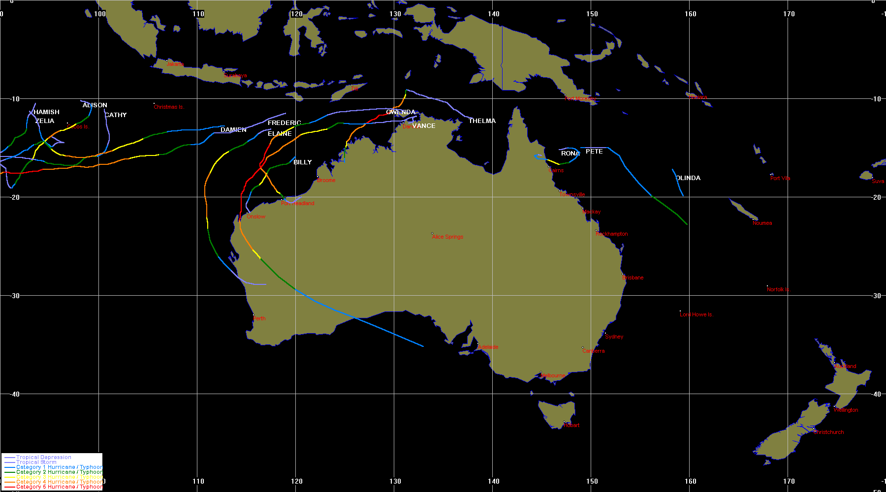
July 1998 to June 1999 Tropical Cyclones in the Australian Region
[Australian Region][South Indian Ocean][South Pacific Ocean][Southern Hemisphere][Summaries and Track Data]
| Tropical
Cyclones
[Index] |
July 1998 to June 1999 Tropical Cyclones in the Australian Region [Australian Region][South Indian Ocean][South Pacific Ocean][Southern Hemisphere][Summaries and Track Data] |

Individual Tropical Cyclone Information
Some part of the cyclone track must occur within 90 E and 180 E (and be in the southern hemisphere) to be included.
| Cyclone Name |
Basin |
Joint Typhoon Warning Centre data | Bureau of Meteorology data | Other Info | ||||||
|---|---|---|---|---|---|---|---|---|---|---|
| TC Num | Dates | Map | Warn | TC Num | Dates | Map | Max Int | |||
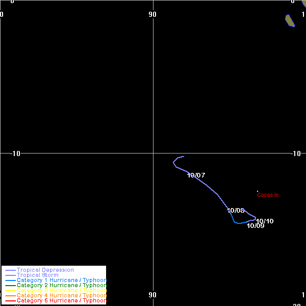
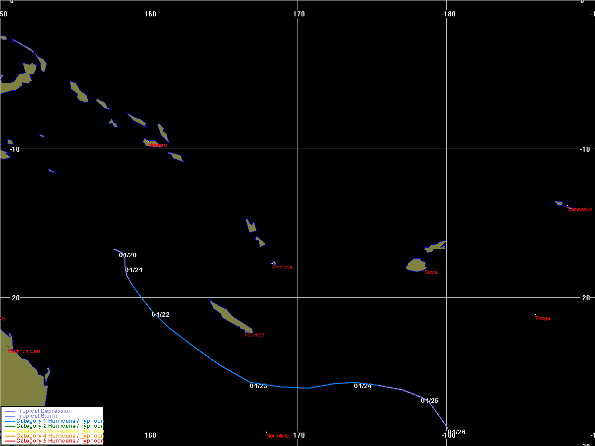
| Zelia | SIO | 9903 | 06 - 10 Oct 1998 | Map | Warn | 199801 | 07 - 10 Oct 1998 | Map | 990 | |
| Alison | SIO | 9904 | 06 - 12 Nov 1998 | Map | Warn | 199802 | 07 - 13 Nov 1998 | Map | 955 | |
| Billy | SIO | 9905 | 01 - 07 Dec 1998 | Map | Warn | 199804 | 02 - 06 Dec 1998 | Map | 965 | |
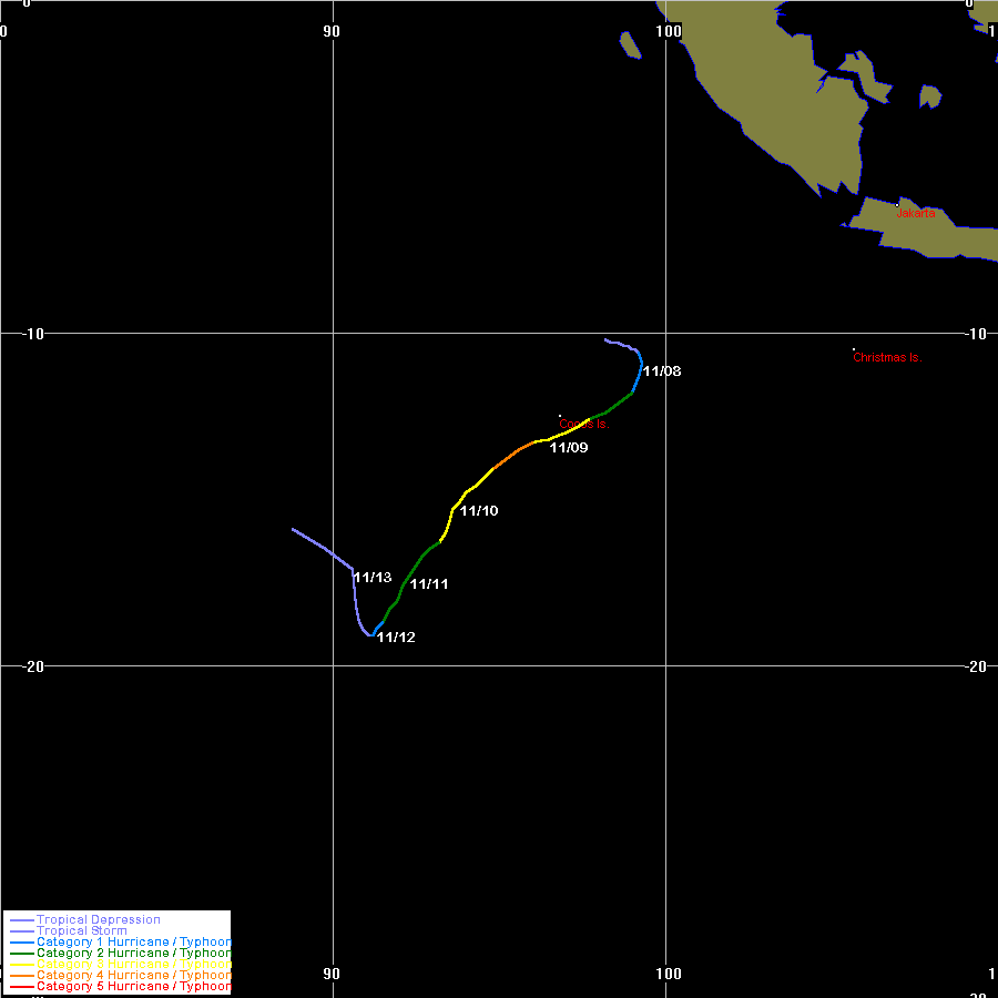
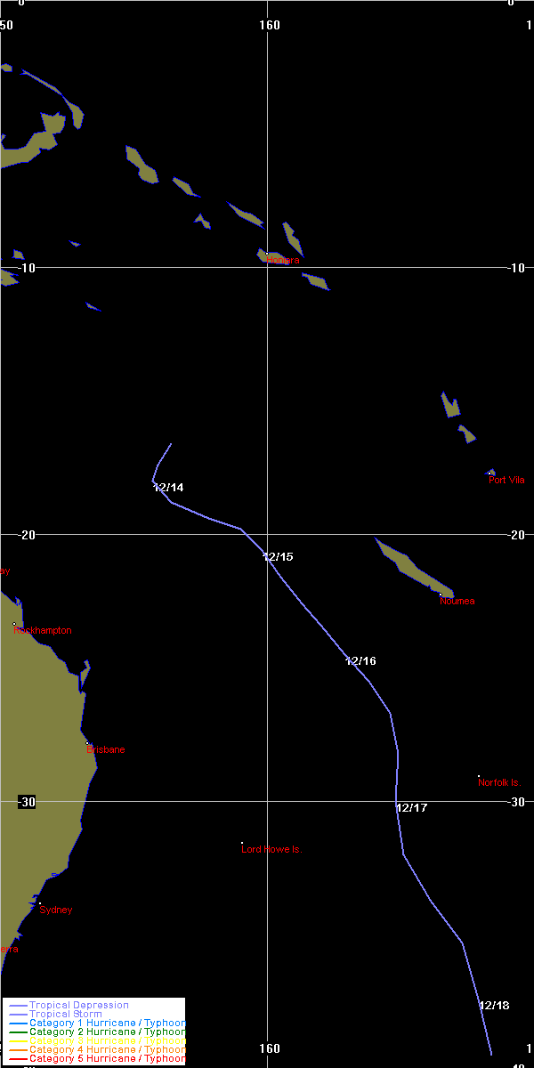
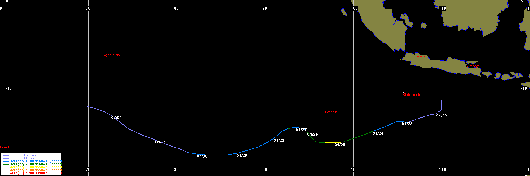
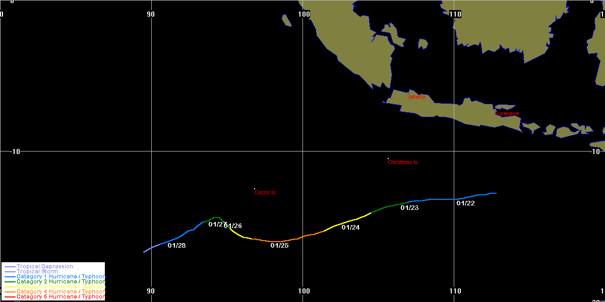
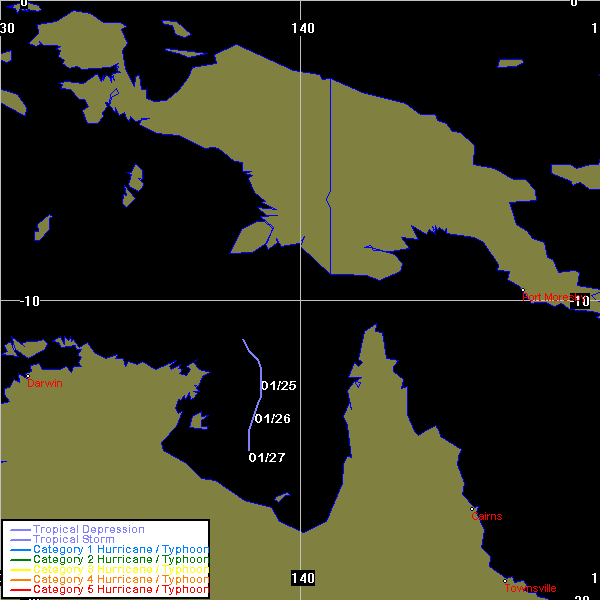
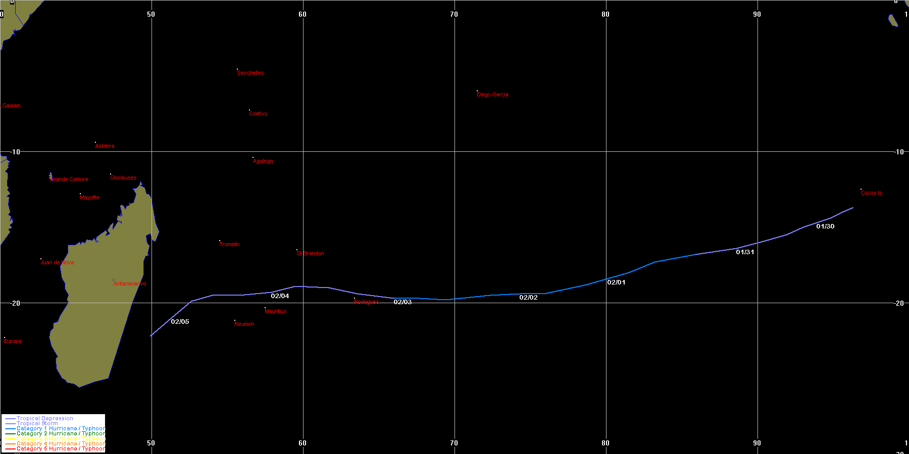
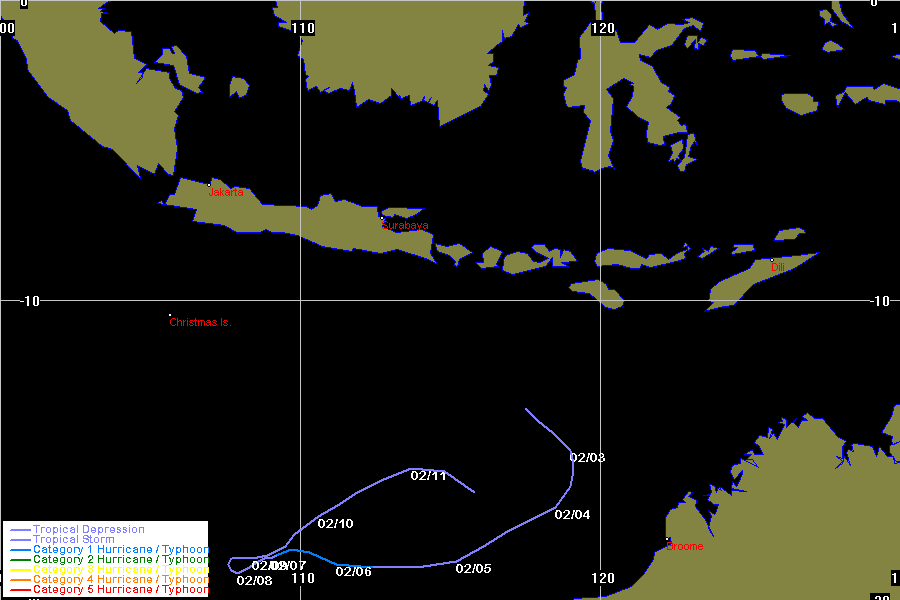
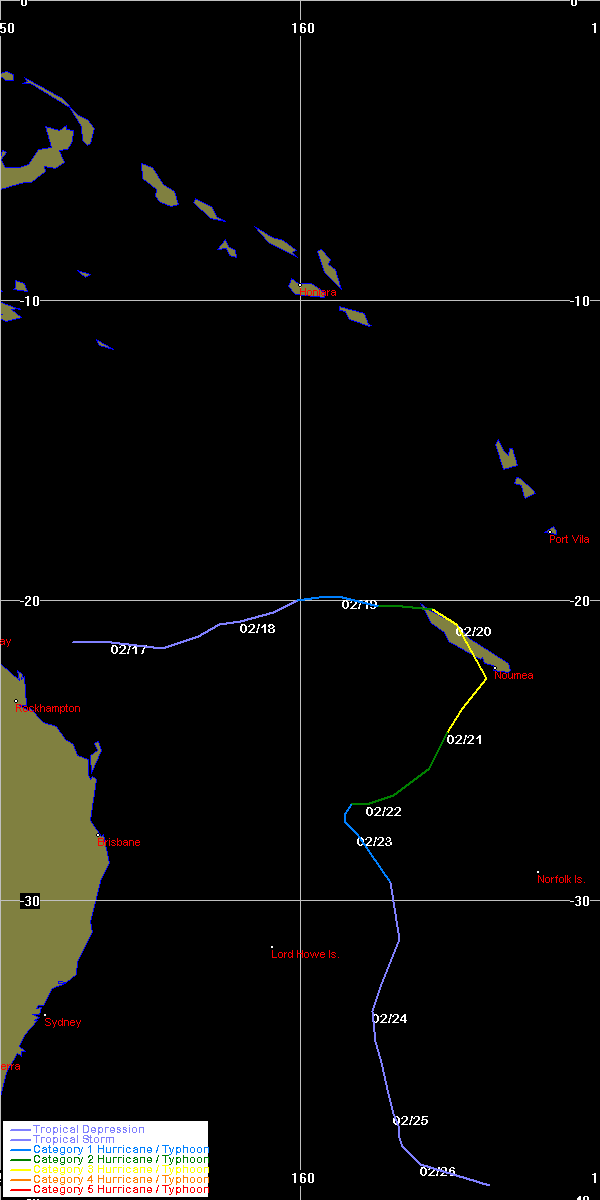
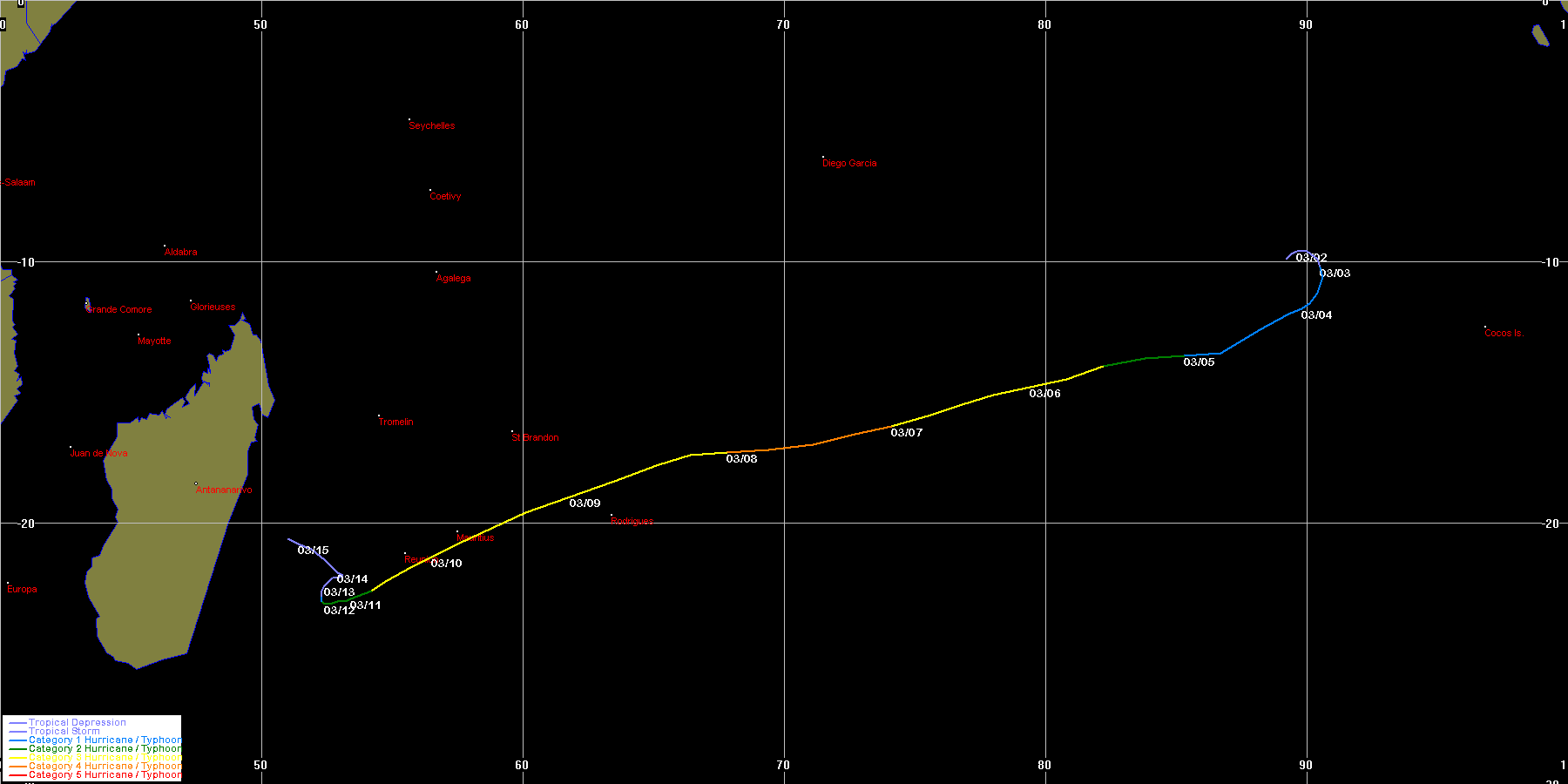
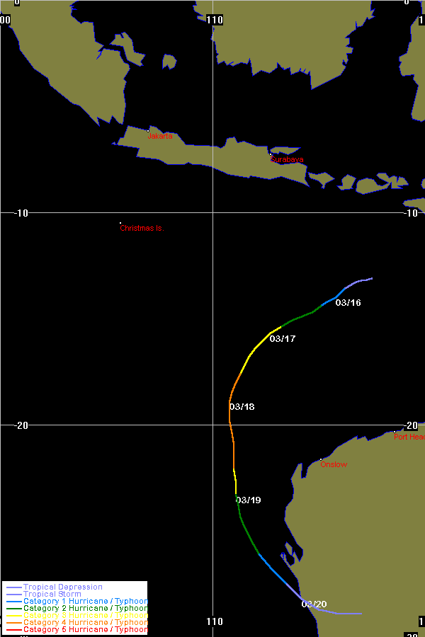
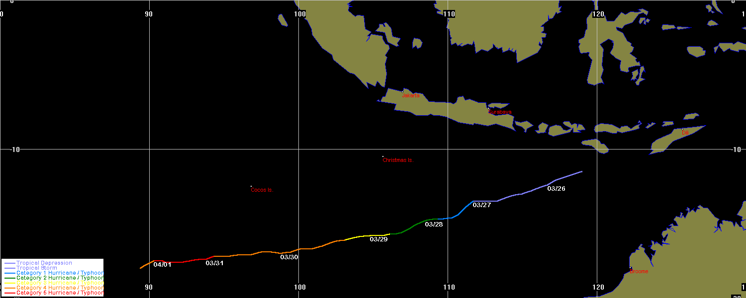
| Thelma | SIO | 9906 | 04 - 15 Dec 1998 | Map | Warn | 199803 | 30 Nov - 11 Dec 1998 | Map | 920 | BoM Report |
| unnamed | SPAC | 9907 | 13 - 18 Dec 1998 | Map | Warn | |||||
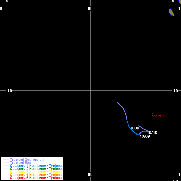
| Cathy | SIO | 9910 | 23 - 30 Dec 1998 | Map | Warn | 199805 | 22 - 28 Dec 1998 | Map | 975 | |
| Dani | SPAC | 9911 | 13 - 23 Jan 1999 | Map | Warn | |||||
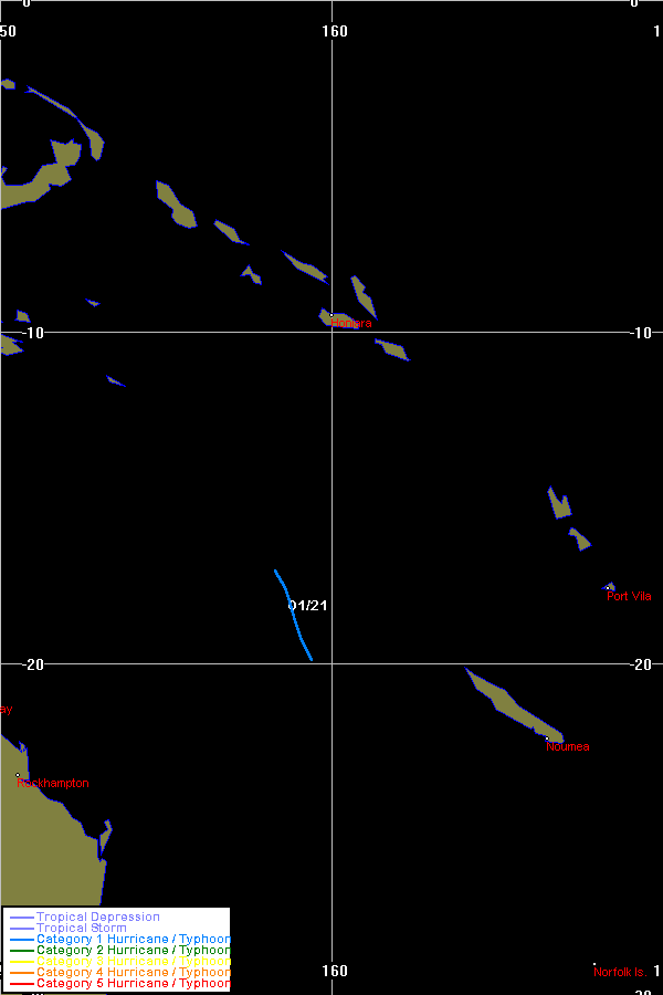
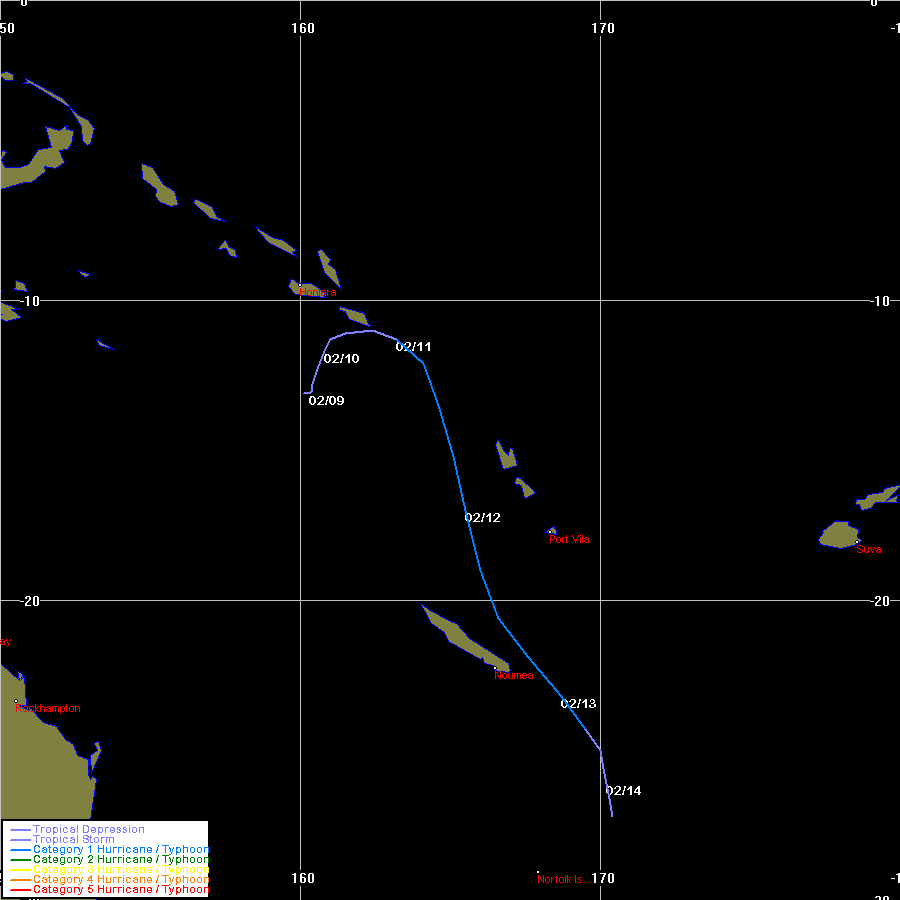
| Olinda | SPAC | 9913 | 19 - 26 Jan 1999 | Map | Warn | 199806 | 20 - 21 Jan 1999 | Map | 987 | |
| Pete | SPAC | 9914 | 21 - 29 Jan 1999 | Map | Warn | 199808 | 21 - 23 Jan 1999 | Map | 985 | |
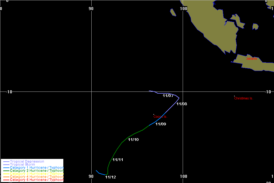
| Damien- Birenda |
SIO | 9915 | 21 Jan - 01 Feb 1999 | Map | Warn | 199807 | 21 - 28 Jan 1999 | Map | 950 | |
| unnamed | both | 9916 | 24 - 27 Jan 1999 | Map | Warn | |||||
| Chikita | SIO | 9917 | 29 Jan - 05 Feb 1999 | Map | Warn | |||||
| unnamed | SIO | 9918 | 02 - 11 Feb 1999 | Map | Warn | |||||
| Ella | SPAC | 9919 | 08 - 14 Feb 1999 | Map | Warn | |||||
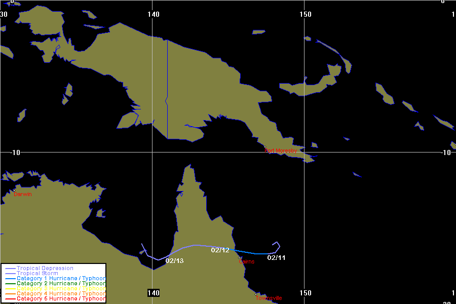
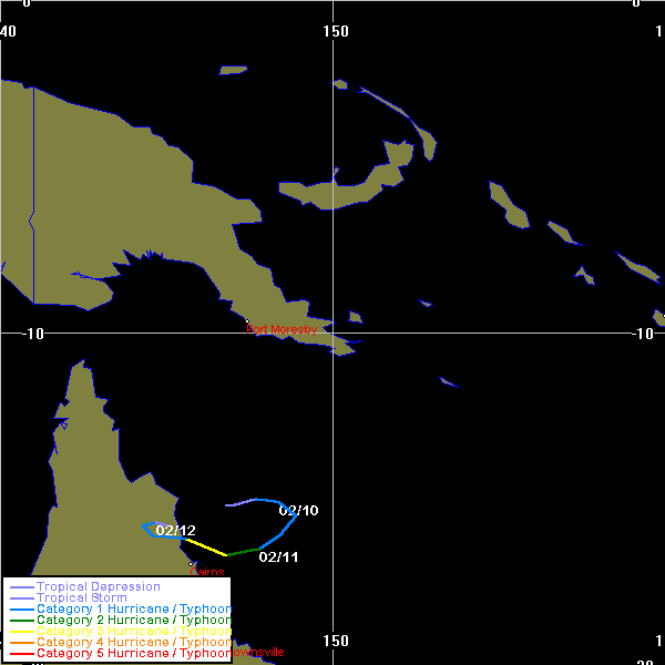
| Rona | SPAC | 9920 | 10 - 13 Feb 1999 | Map | Warn | 199809 | 09 - 12 Feb 1999 | Map | 970 | |
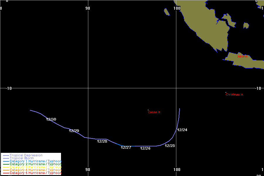
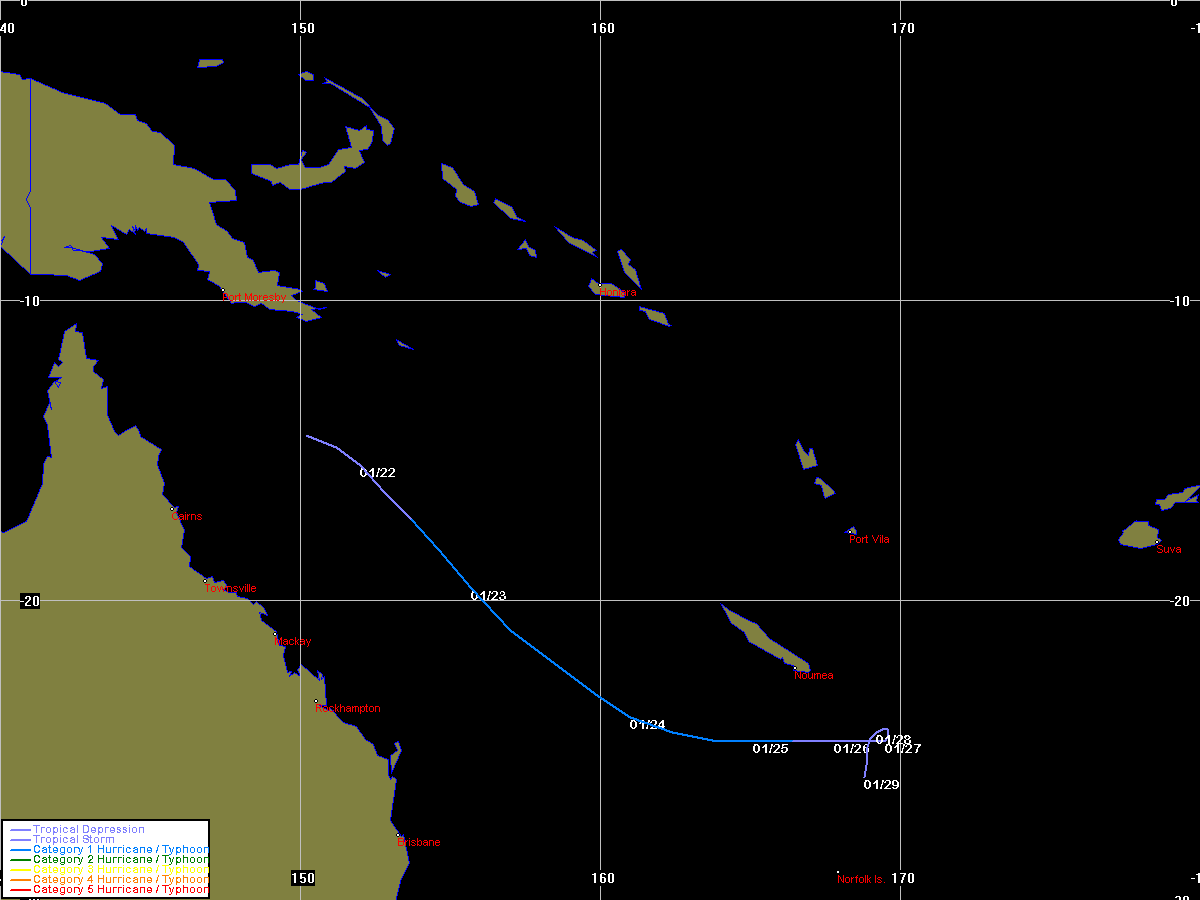
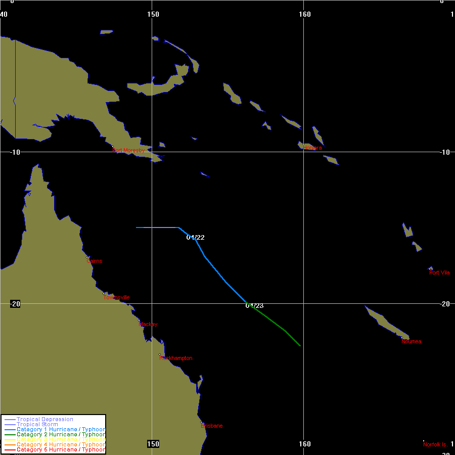
| Frank | SPAC | 9922 | 16 - 26 Feb 1999 | Map | Warn | |||||
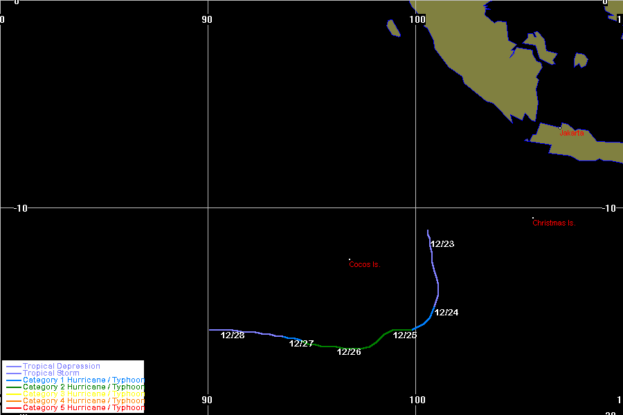
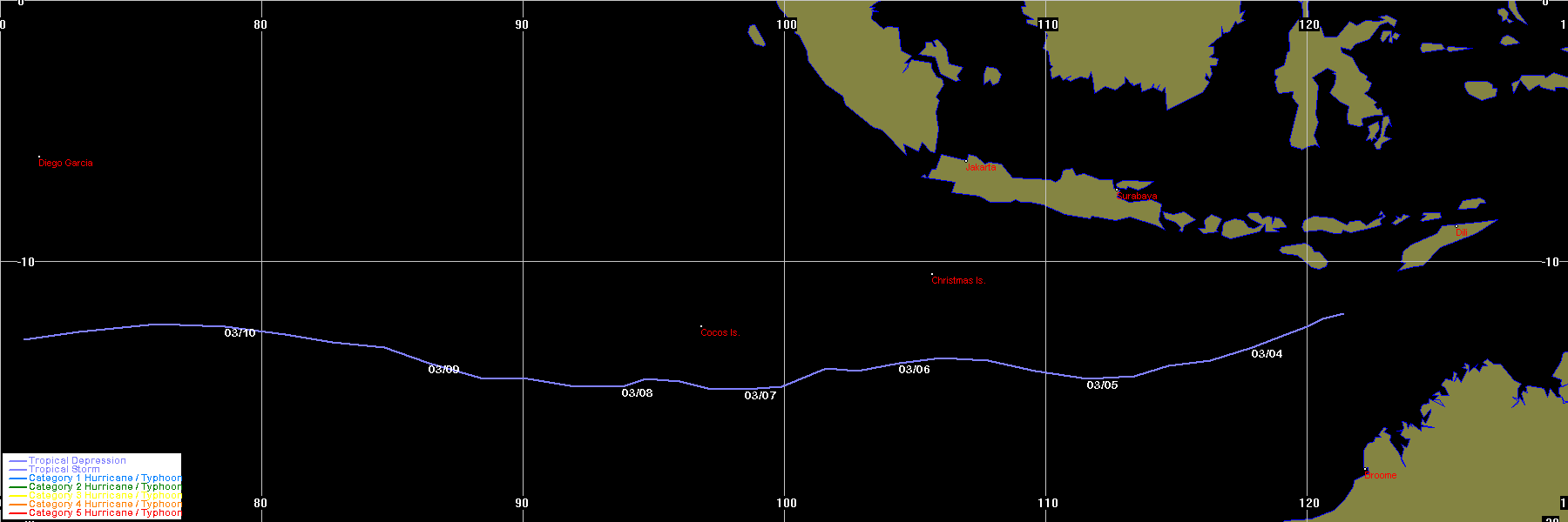
| Davina | SIO | 9925 | 01 - 15 Mar 1999 | Map | Warn | |||||
| unnamed | SIO | 9926 | 03 - 10 Mar 1999 | Map | Warn | |||||
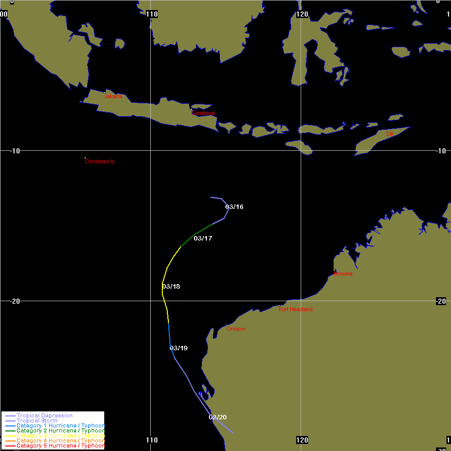
| Elaine | SIO | 9928 | 15 - 20 Mar 1999 | Map | Warn | 199811 | 15 - 20 Mar 1999 | Map | 945 | |
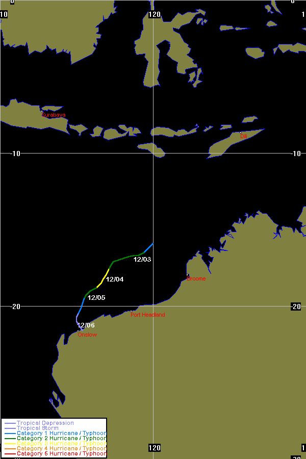
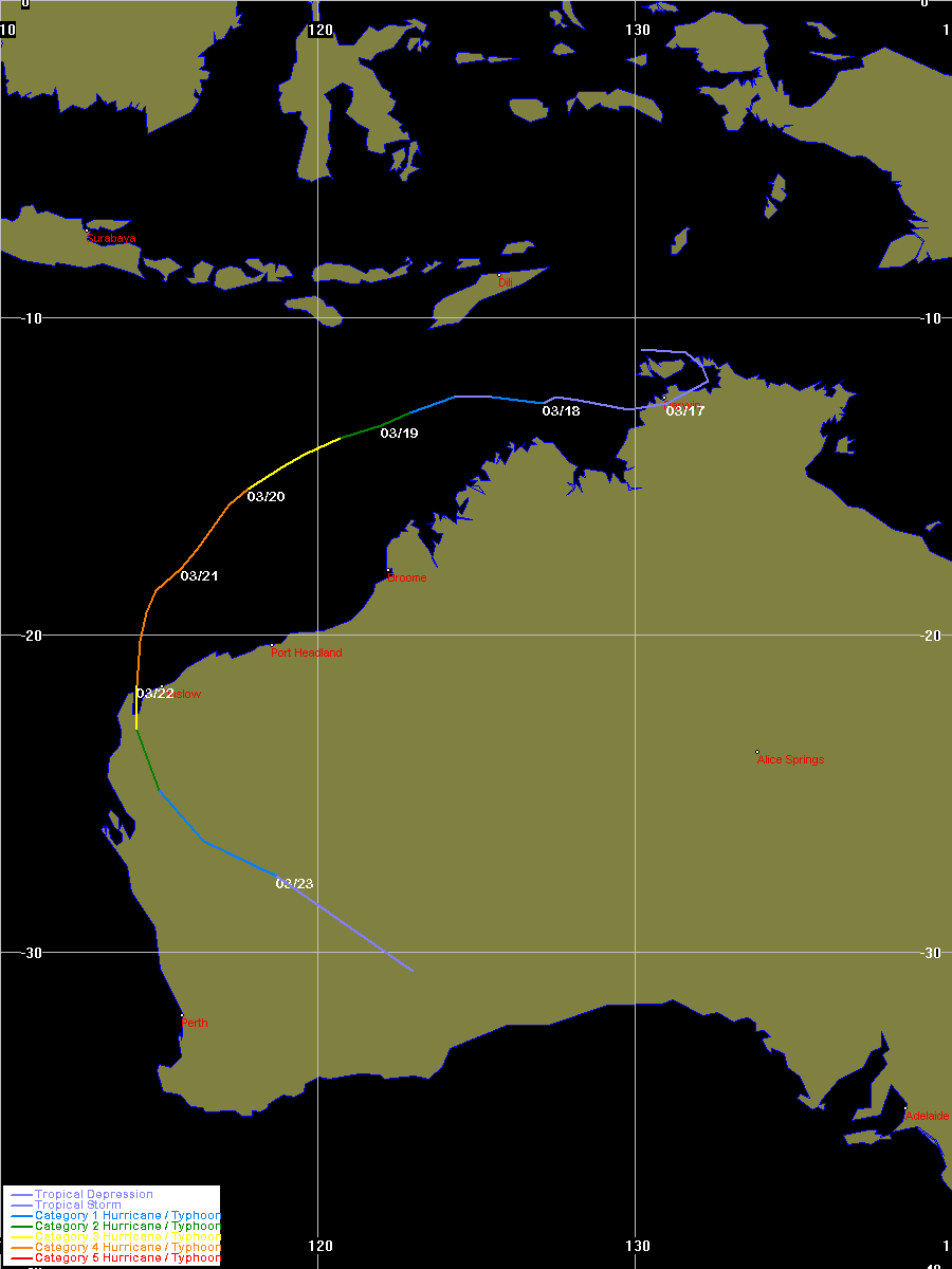
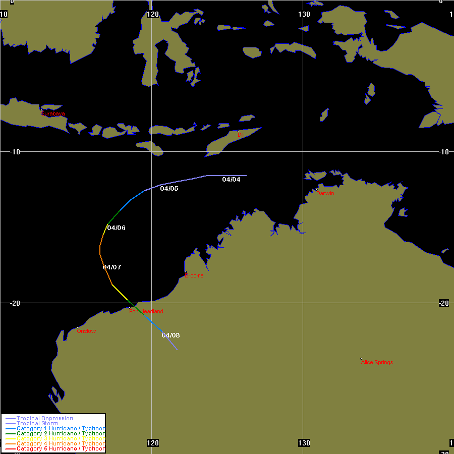
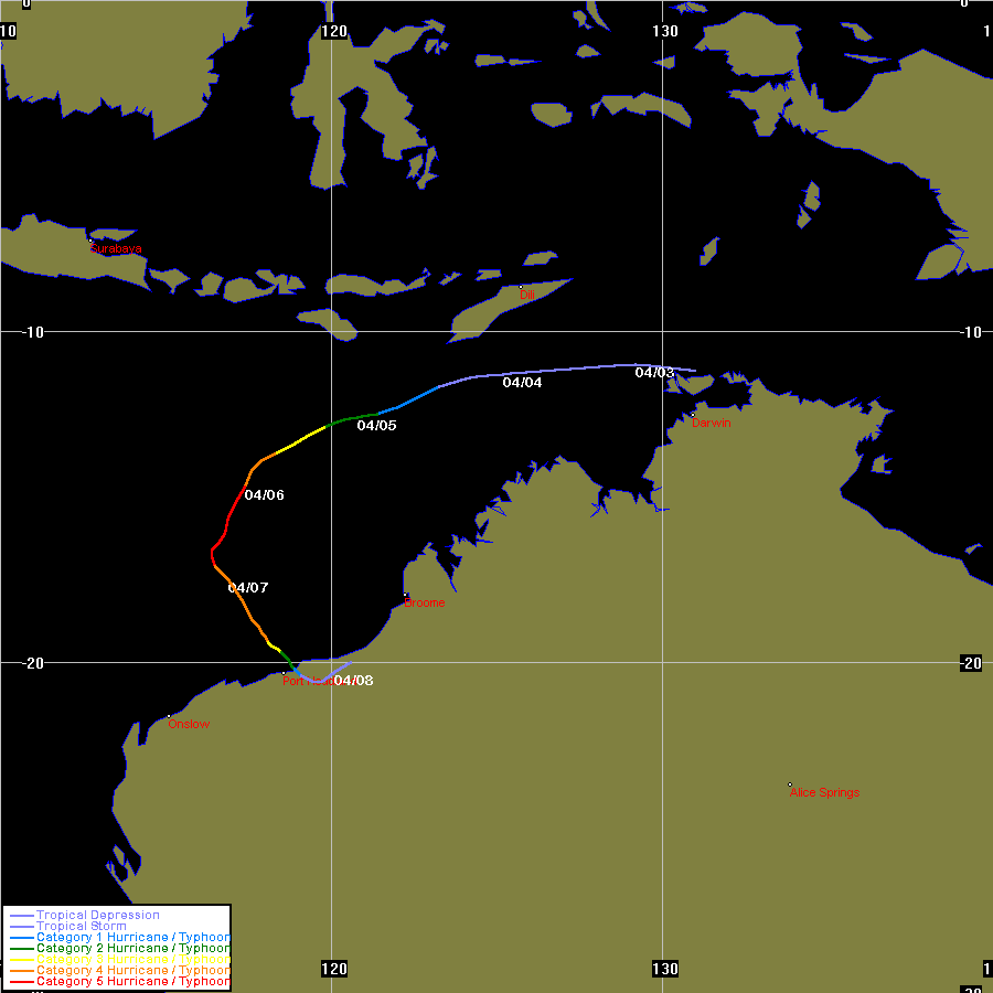
| Vance | SIO | 9930 | 16 - 23 Mar 1999 | Map | Warn | 199810 | 14 - 23 Mar 1999 | Map | 910 | BoM Report |
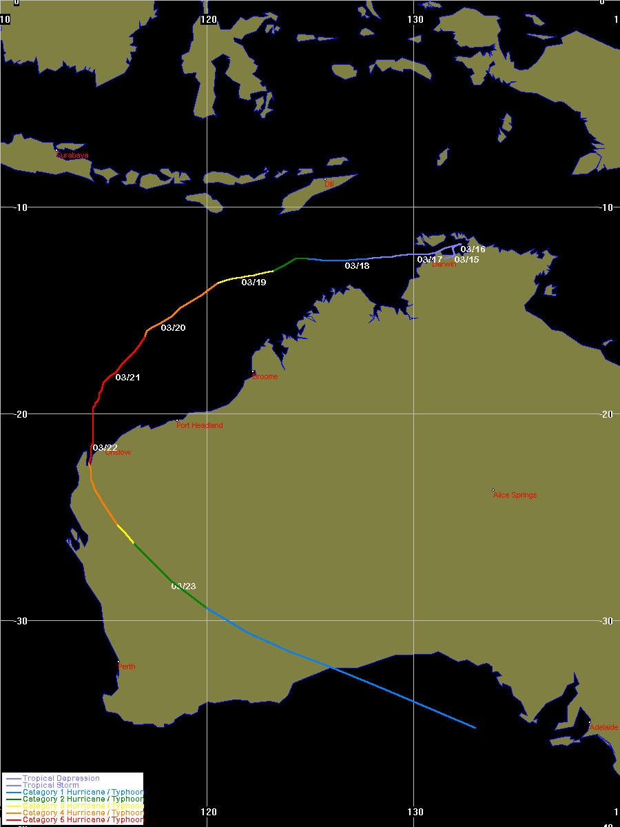
| Frederic- Evrina |
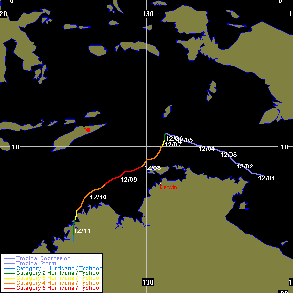
both | 9931 | 25 Mar - 07 Apr 1999 | Map | Warn | 199812 | 25 Mar - 01 Apr 1999 | Map | 920 | |
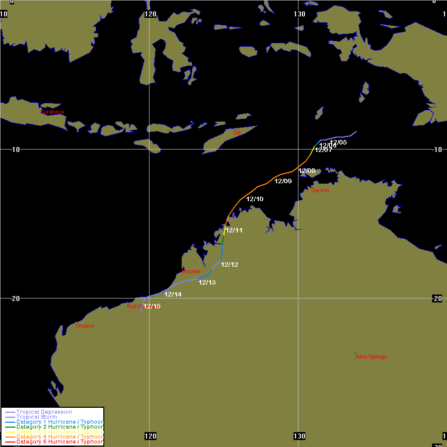
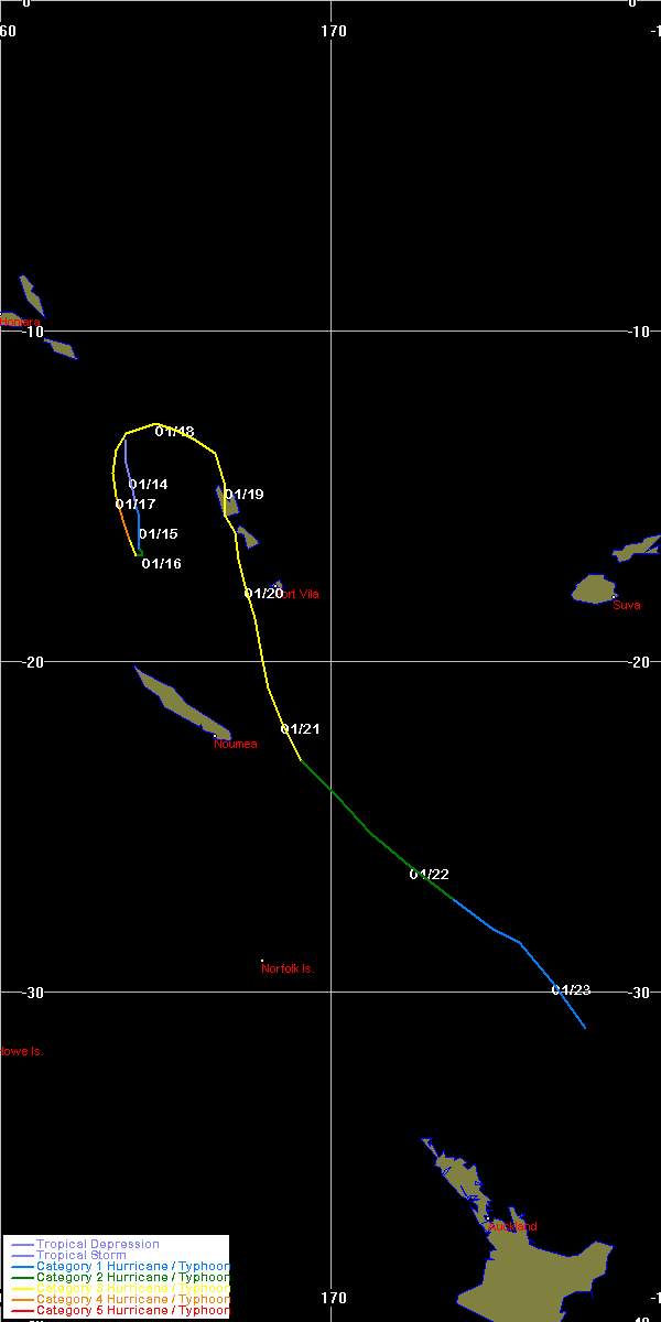
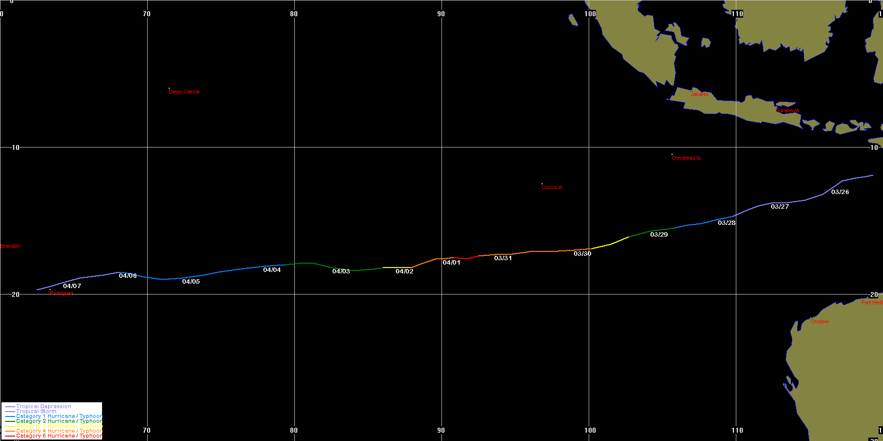
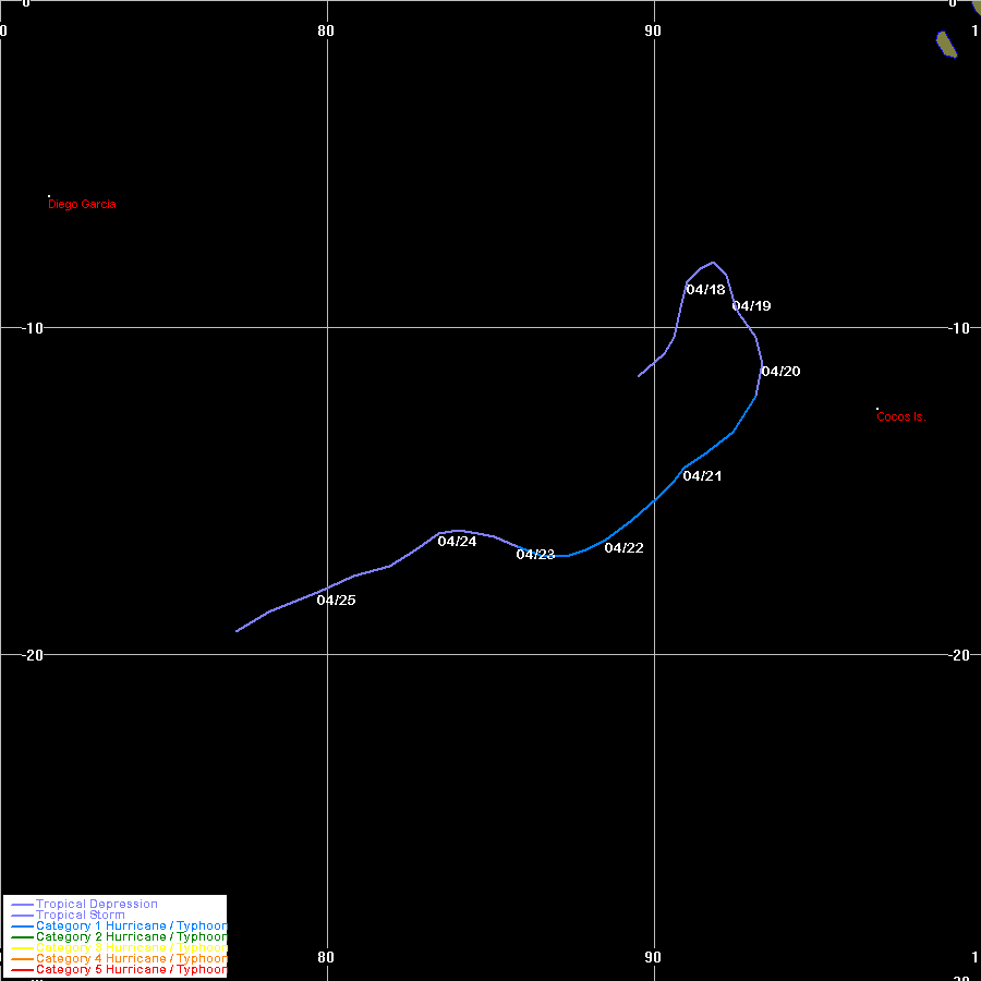
| Gwenda | SIO | 9932 | 03 - 08 Apr 1999 | Map | Warn | 199813 | 02 - 08 Apr 1999 | Map | 900 | |
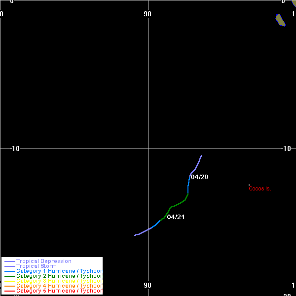
| Hamish | SIO | 9933 | 17 - 25 Apr 1999 | Map | Warn | 199814 | 19 - 21 Apr 1999 | Map | 980 | |
| Cyclone Name |
Basin |
Joint Typhoon Warning Centre data | Bureau of Meteorology data | Other Info | ||||||
| TC Num | Dates | Map | Warn | TC Num | Dates | Map | Max Int | |||
BoM data obtained from the Bureau of Meteorology, Melbourne
JTWC data obtained from the Naval Pacific Meteorology and Oceanography / Joint Typhoon Warning Centre, Hawaii
Historical Season Maps for all seasons that data is available.
Plotting Information about the track maps on this website. Also includes southern hemisphere TC regions and BoM TC intensity classification scale.
All maps produced by Michael Bath
|
Document: tropical_cyclones_1999_australian_region.htm
Updated: 11th May 2006 |
[Australian Severe Weather index] [Copyright Notice] [Email Contacts] [Search This Site] |