and Chasing
[Index][Archives]
Cold Snap hits Melbourne: Thursday 9th July 1998
by Jane ONeill
| Storm News and Chasing [Index][Archives] |
Cold Snap hits Melbourne: Thursday 9th July 1998 by Jane ONeill |
By 10am, it had turned bitterly cold with a fresh SW wind and towering cumulus developing rapidly. By 12 noon, we had already had some sleet and small hail both in the city and the suburbs and the temperature had fallen to 3.4 deg ensuring that hail in some areas did not melt for a couple of hours.
Light snow had fallen on and off during the morning at Olinda and there was still a light dusting at 3pm, after which the cloud cover broke up to reveal towering cumulus sailing up from the south.
The maximum temperature for the day was 7 deg. At 6pm, humidity was 62%, pressure 1020 and rising. By 9pm the temperature had risen to 7.6 degrees.
See also Michael Thompson's Snow Chase from the 10th July 1998.
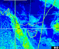
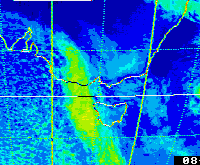
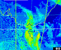
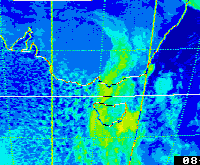
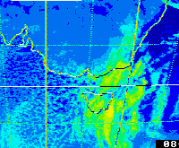
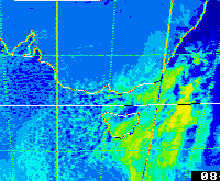
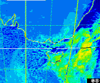
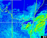
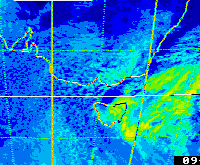
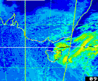
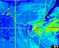
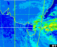
These images obtained from James Cook University
Infrared Satellite Images from 1pm 8th July to 12pm 9th July local time in 3 hourly increments.
Click the first image for an animation.
|
Document: 9807-02.htm
Updated: 14th January, 2003 |
[Australian Severe Weather index] [Copyright Notice] [Email Contacts] [Search This Site] |