and Chasing
[Index][Archives]
NSW Thunderstorms: Friday 4th September 1998
by Paul Graham
| Storm News and Chasing [Index][Archives] |
NSW Thunderstorms: Friday 4th September 1998 by Paul Graham |
According to the Bureau of Meteorology, thunderstorm activity was reported in the Upper Western, Northwest Slopes and Plains, Central west Slopes and Plains, Central Tablelands, Southern Tablelands and Southwest Slopes. Severe thunderstorm advisories were issued around 11am for possible destructive winds and hail in the southern and central parts of the state. There are no reports at this stage of any damage.
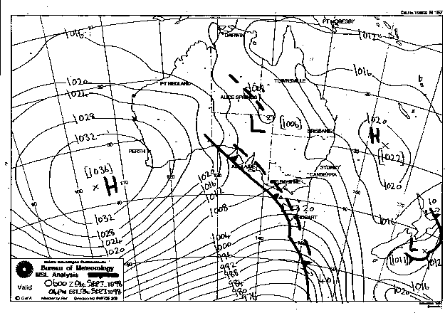
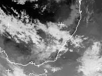
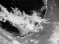
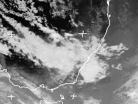
The 4pm sea level analysis chart shows the frontal system in the Great Australian Bight with a pre-frontal trough extending from south east of Tasmania north into South Australia. The satellite images (from left: 10am, 1pm and 4pm local) show convective cloud bands over south eastern Australia associated with the pre-frontal trough and the thunderstorm activity. September is usually the start of the severe storm season and September 4th, 1998 appears to be and early start for this year.
This image obtained from the Bureau of Meteorology
These images obtained from the Dundee University
|
Document: 9809-01.htm
Updated: 14th January, 2003 |
[Australian Severe Weather index] [Copyright Notice] [Email Contacts] [Search This Site] |