and Chasing
[Index][Archives]
Violent Winds and Flash Flooding - Another Probable HP Supercell on the NSW North Coast: Thursday 18th March 2004
by Michael Bath including photos by Dave Ellem
| Storm News and Chasing [Index][Archives] |
Violent Winds and Flash Flooding - Another Probable HP Supercell on the NSW North Coast: Thursday 18th March 2004 by Michael Bath including photos by Dave Ellem |
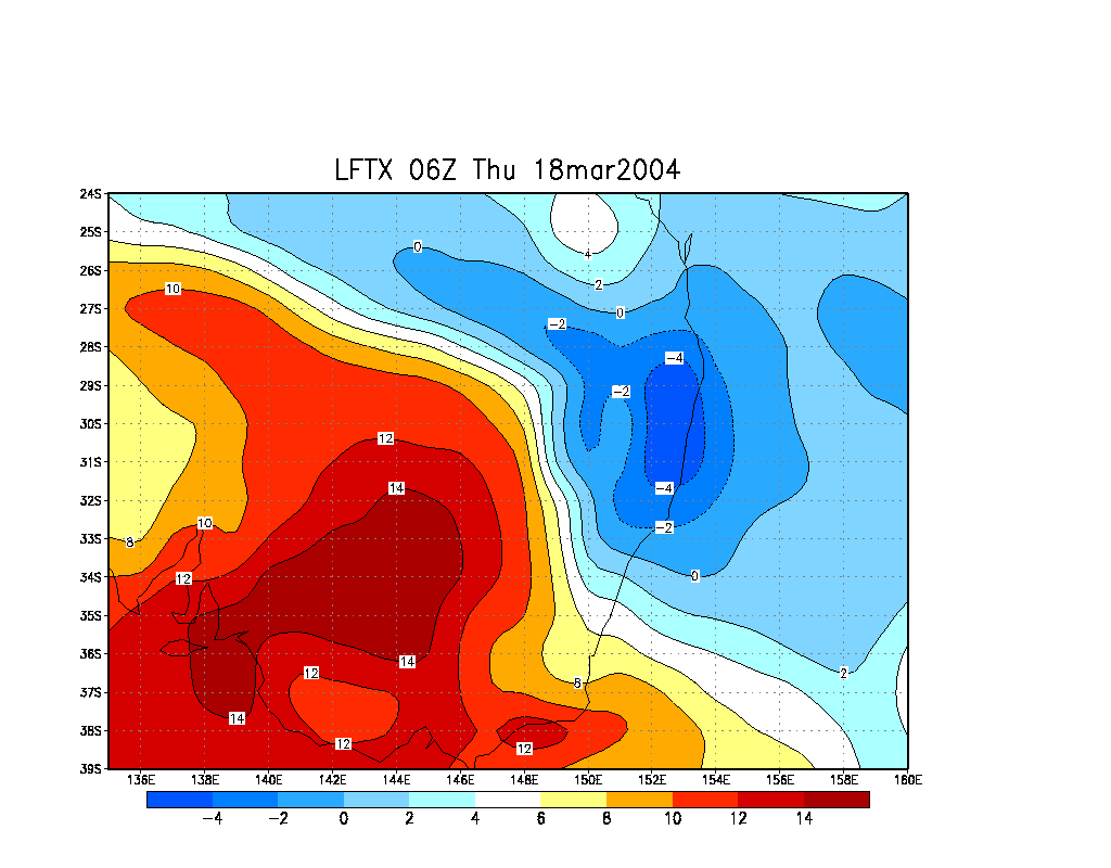
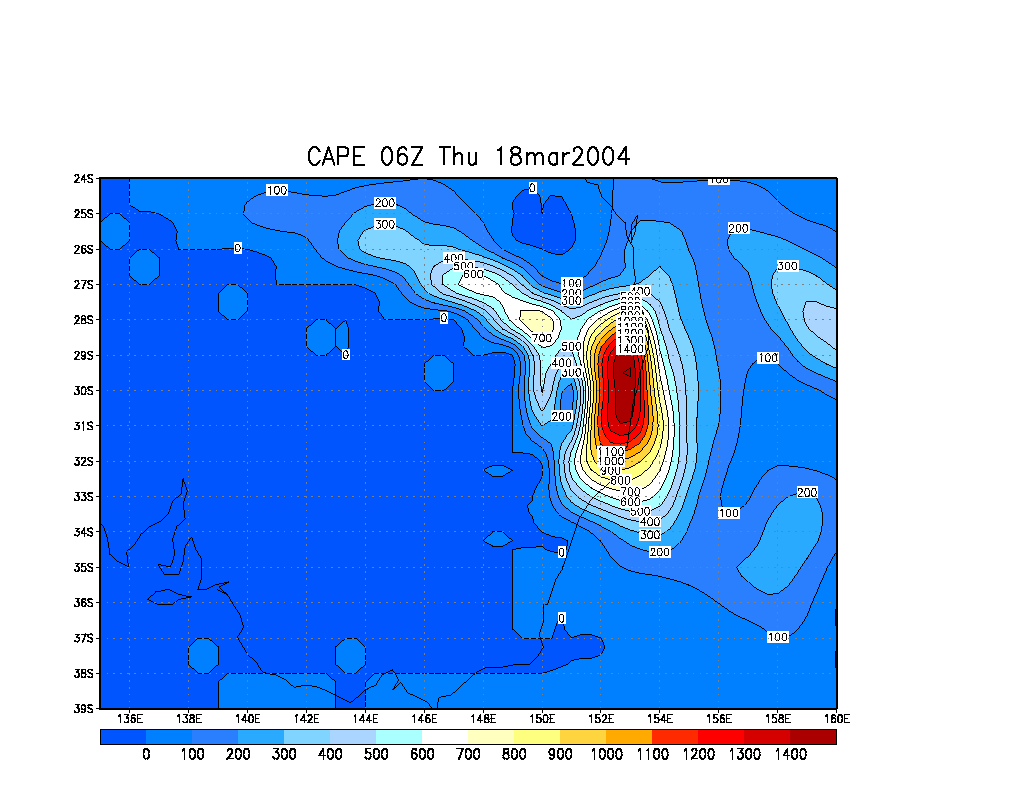
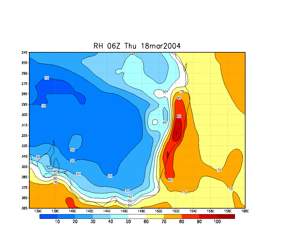
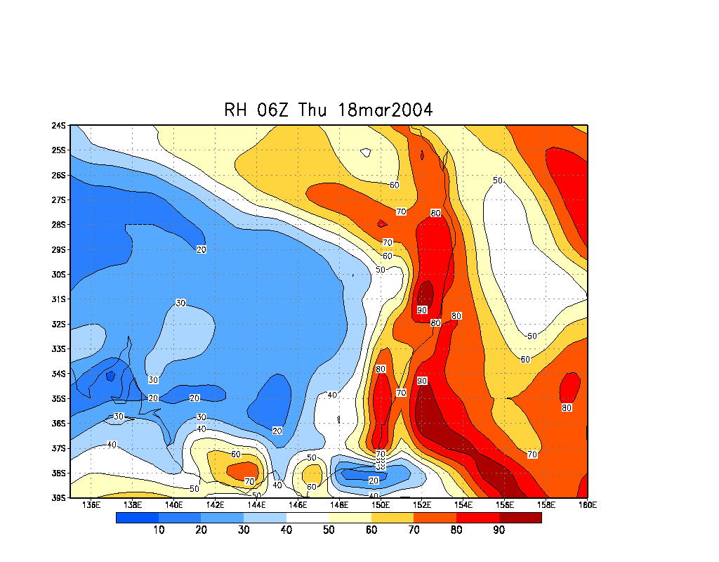
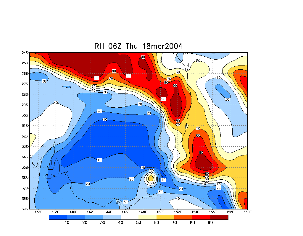
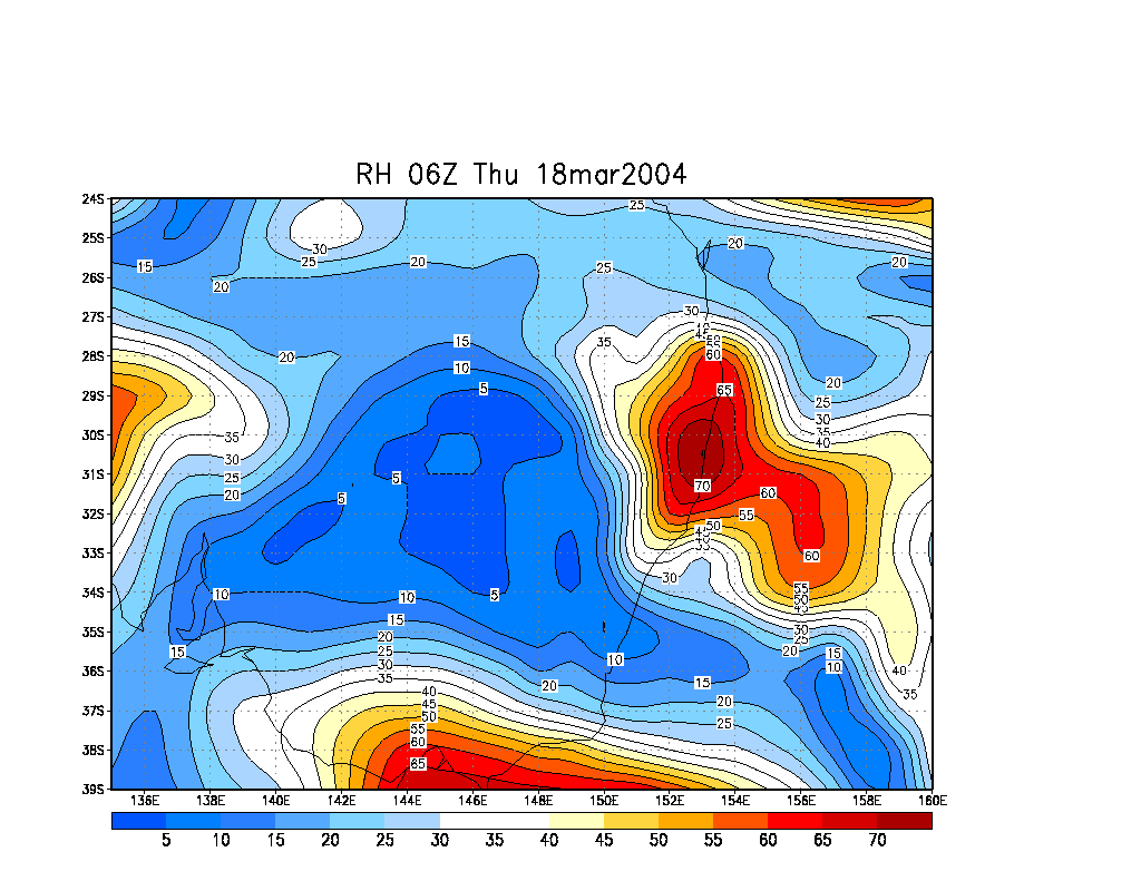
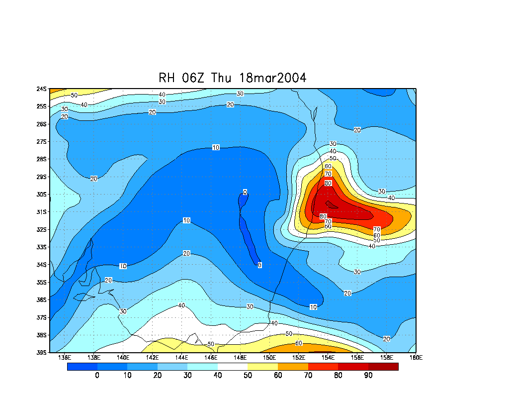
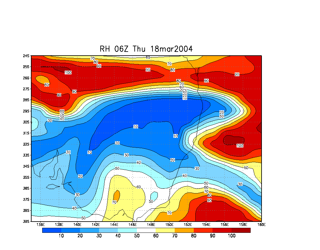
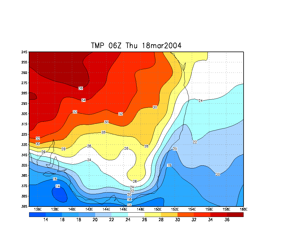
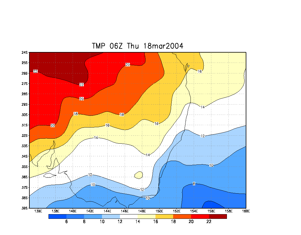
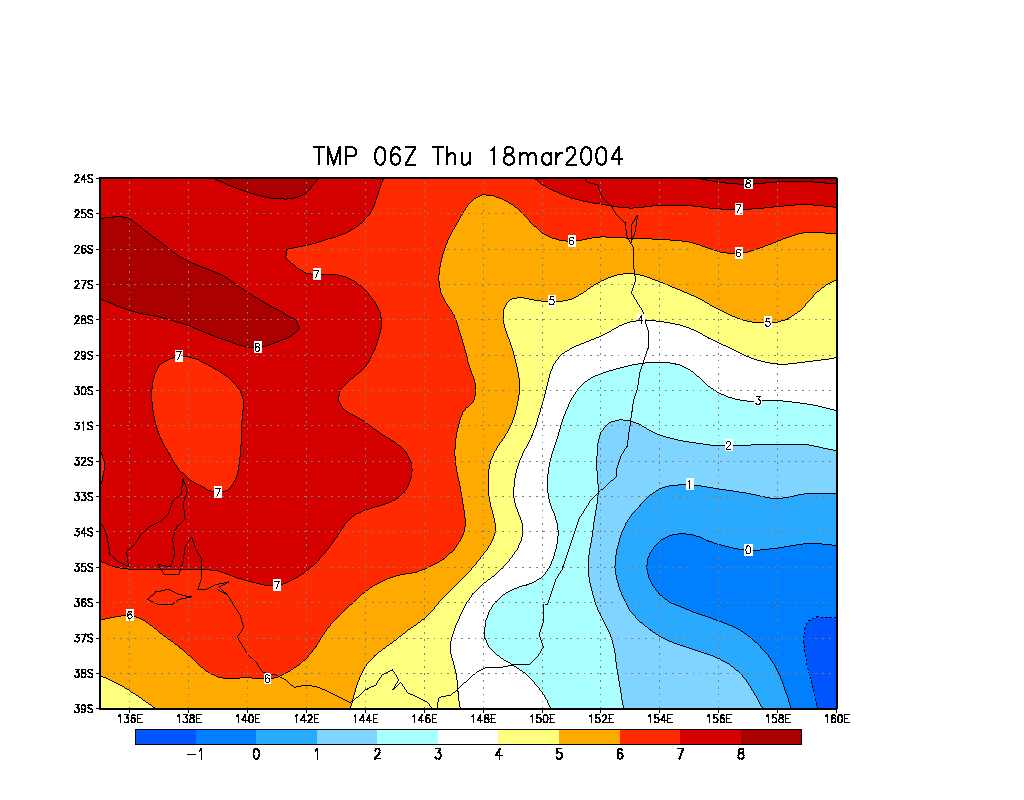
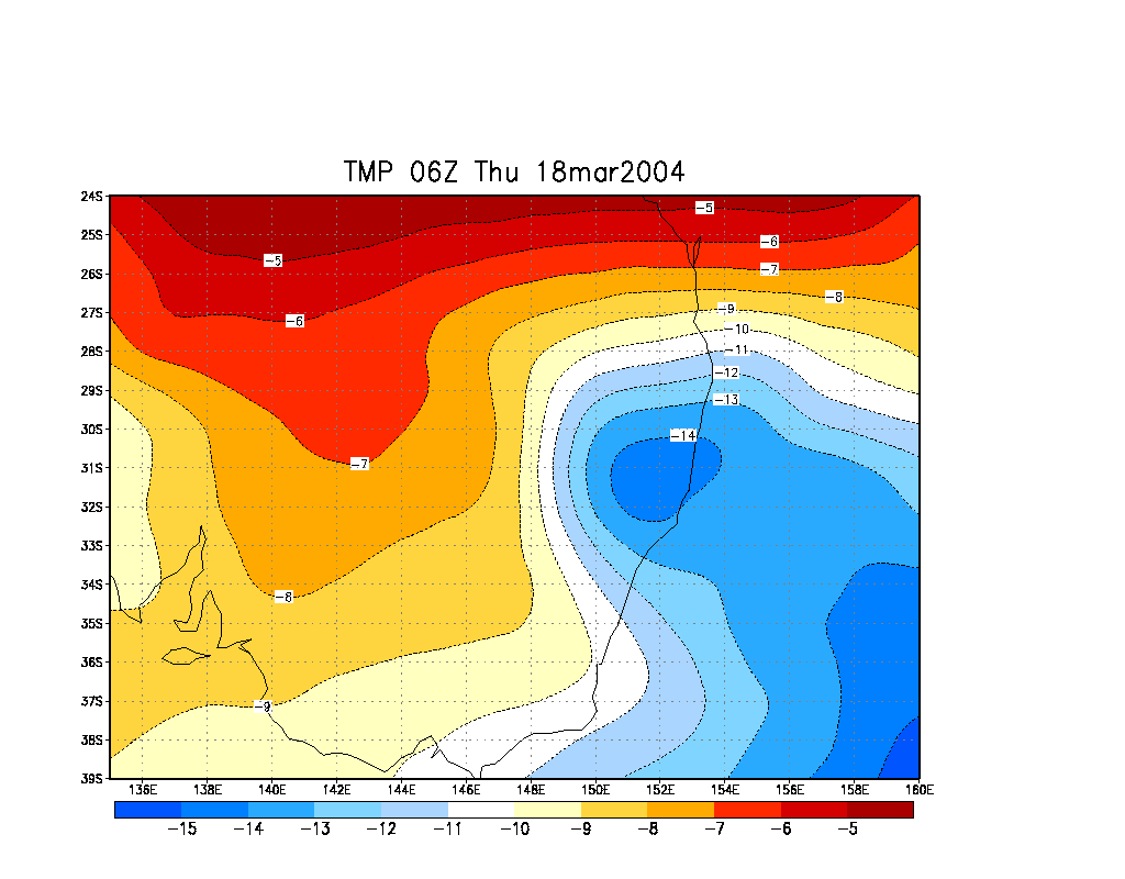
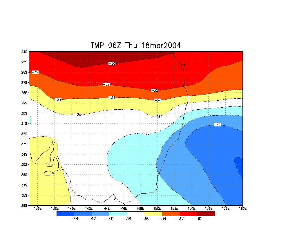
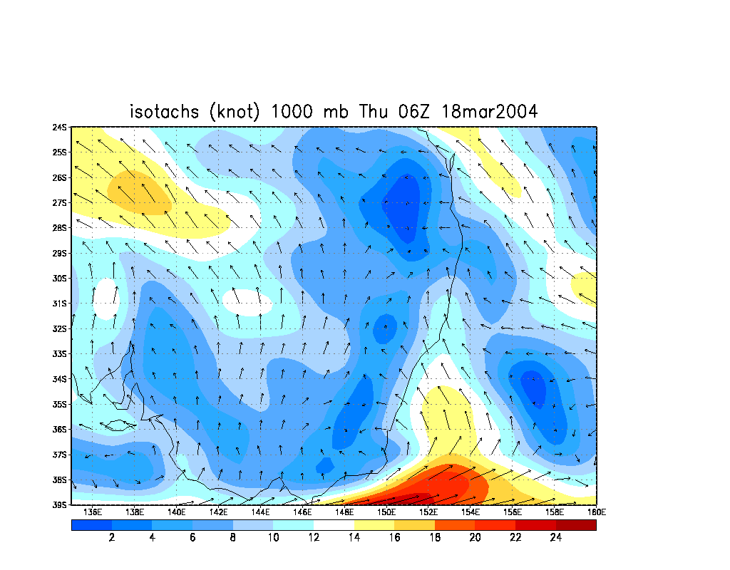
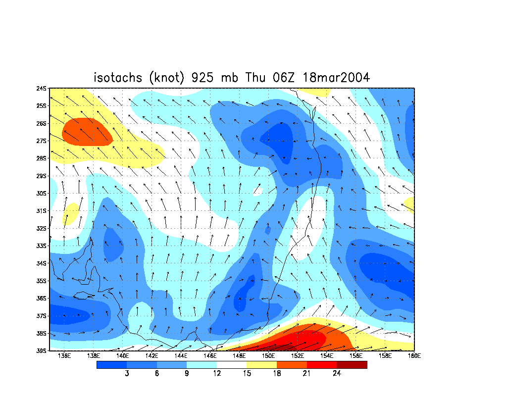
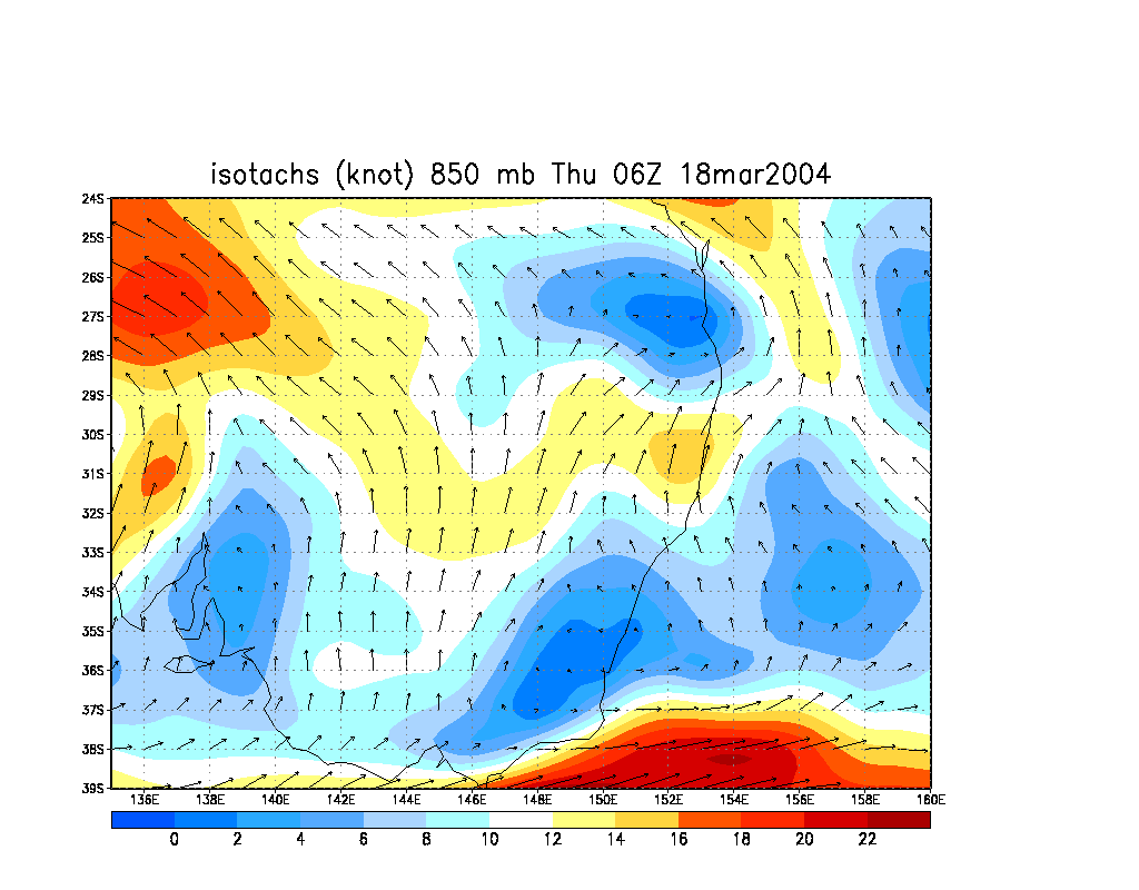
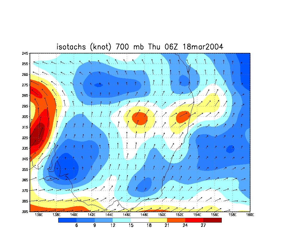
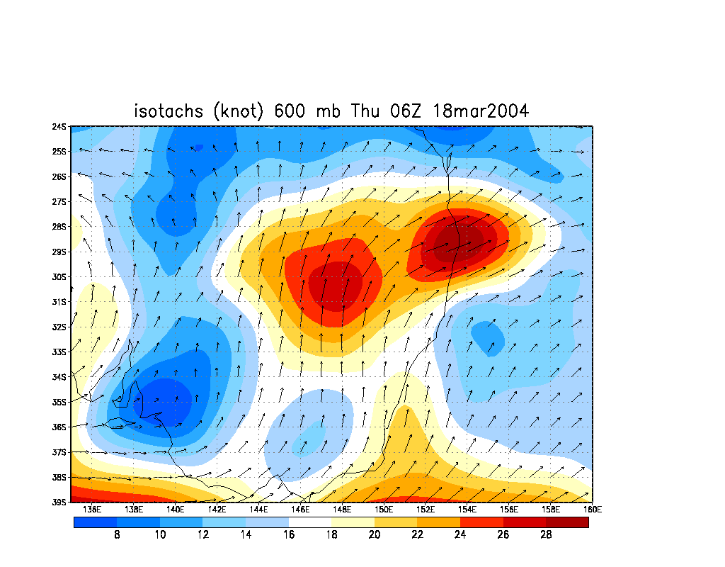
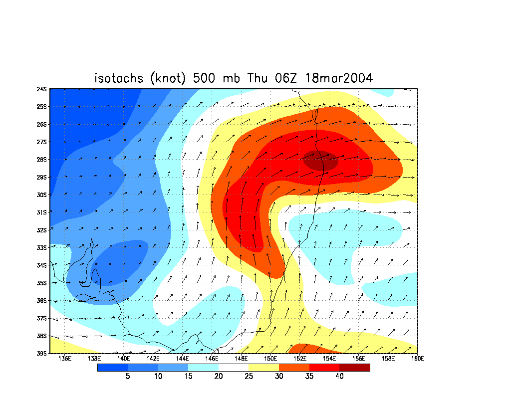
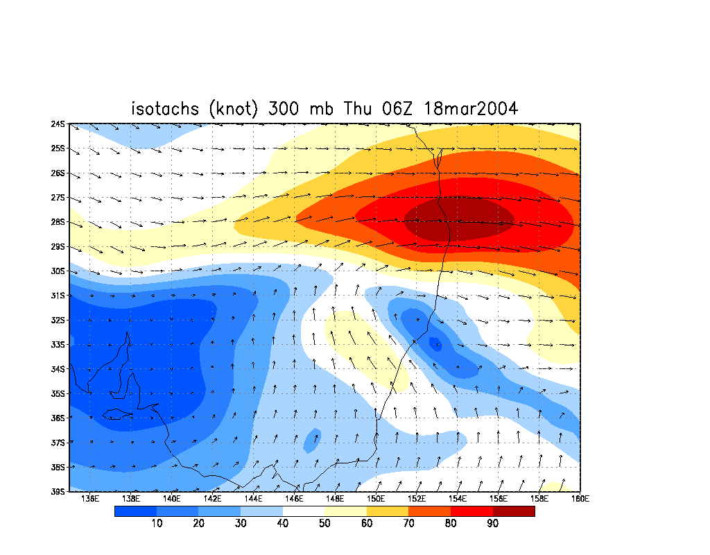
It had been ages since any interesting stormy weather on the Far North Coast so local chasers were suffering a bit of SDS and didn't pay as much attention to the setup as they should have until the day in question. In fact, I didn't really even check the forecast on the day apart from LI and a few key wind levels ! It was just so busy with work, that I left the analysis of the setup to Dave Ellem. GFS (AVN) model revealed a cold pool at 500hPa, dropping as low as -13 on the Far North Coast by 06z (5pm). Surface temperatures got to about 30 C at a maximum. Shear was excellent, 90 knots W at 300, 40 knots WSW at 500, 25 knots SW at 700 and 15knots SSW at 850, though the low level shear was ill-defined and fairly weak. Relative humidity was in abundance at most levels, though dry at the jet level.
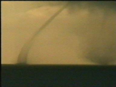
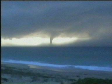
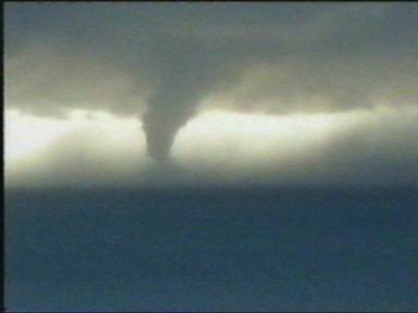
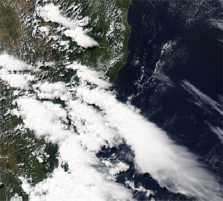
Storms had already formed before dawn in the Sydney area and coastal supercells were offshore and along the Central and Hunter coasts during the morning. Some remarkable footage of waterspouts and a tornado over water was captured by an unknown photographer at The Entrance:
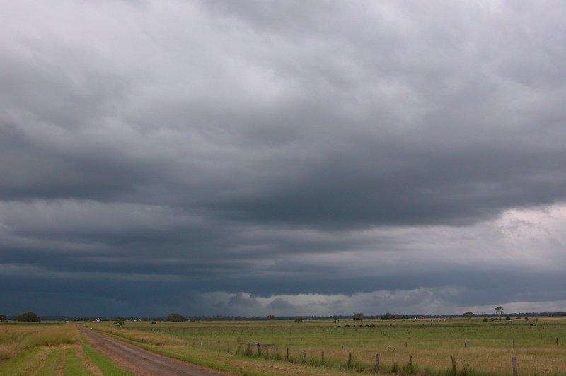
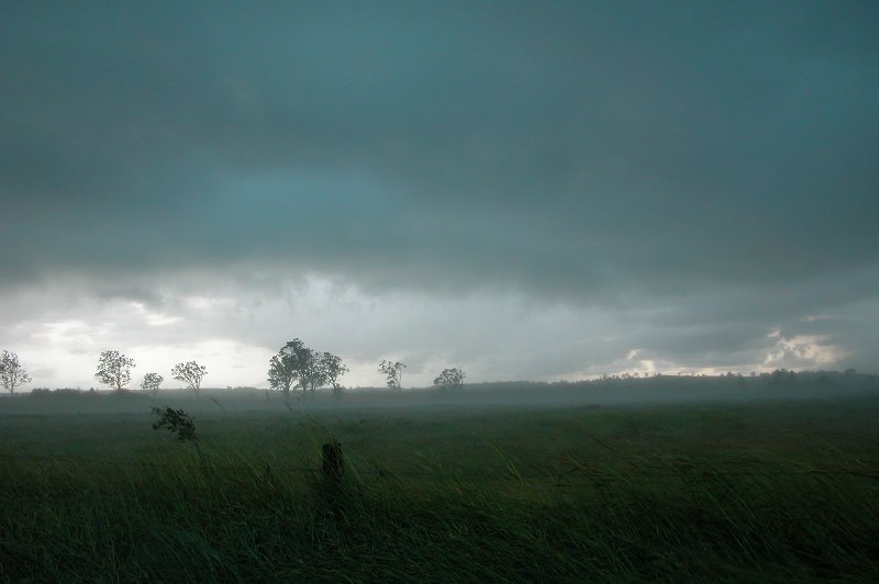
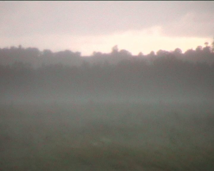
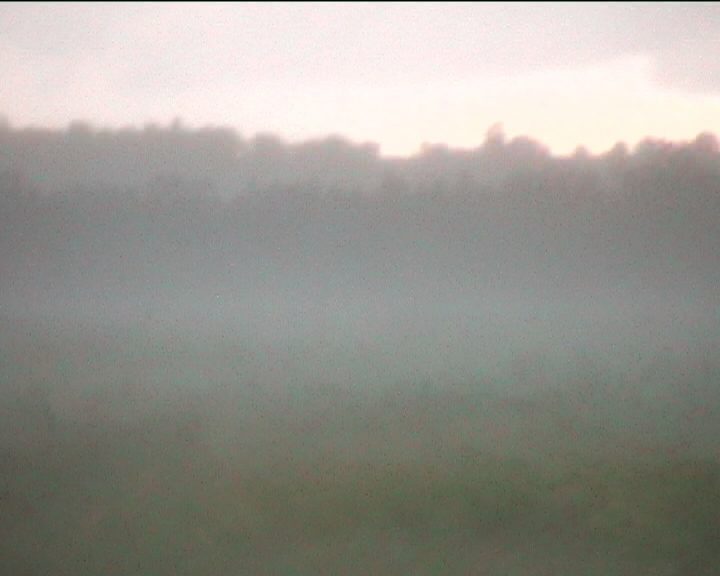
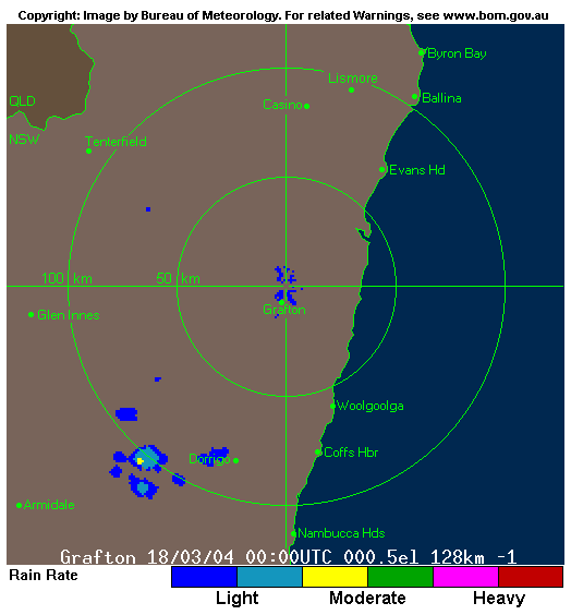
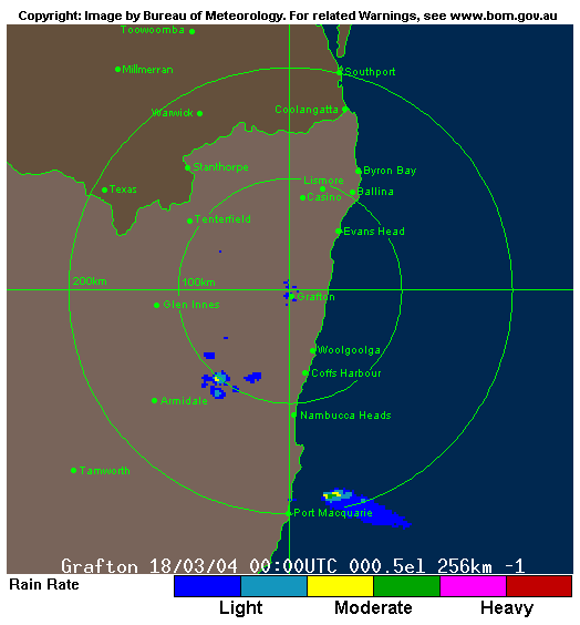
On the Far North Coast the morning started off with fog in the valleys. This quickly burnt off ahead of cumulus development from mid morning. Some larger clouds including some congestus occurred on the local hills to the N, NW and W, with storms well established in the Dorrigo area by 11am. Obviously no capping today. Radar indicated severe storms west of Coffs Harbour with a cell splitting at noon, the right mover weakened just south of Coffs Harbour, the left mover a probable supercell heading NE to the coast east of Grafton.
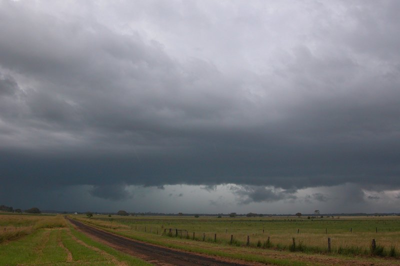
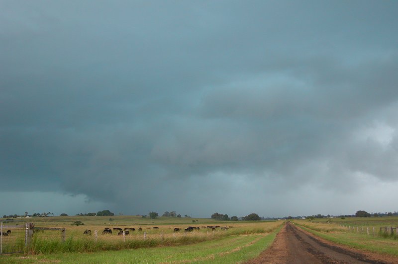
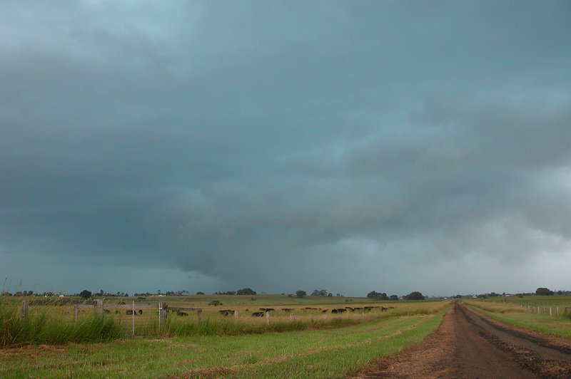
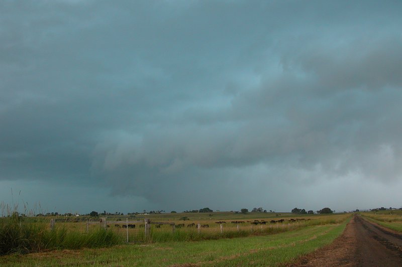
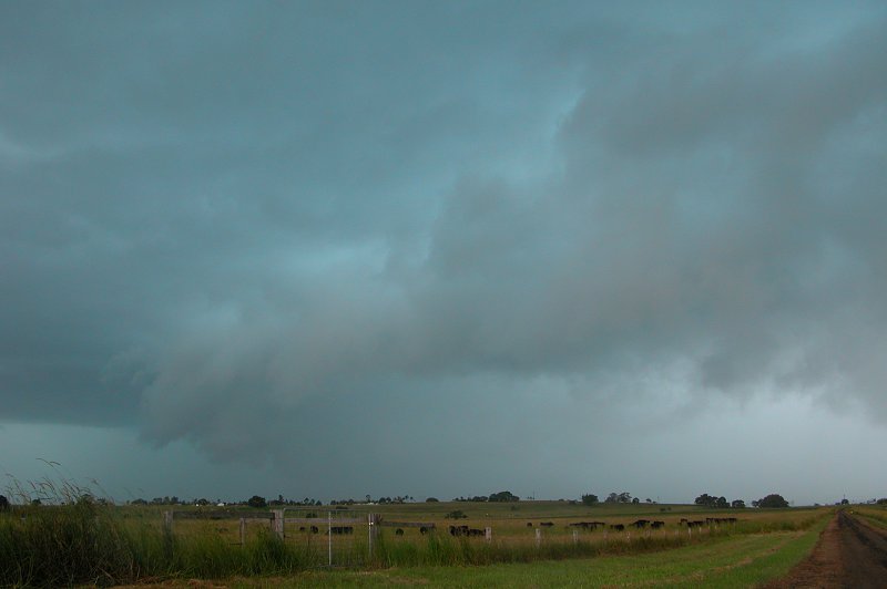
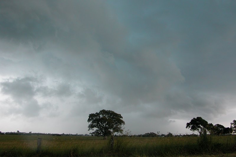
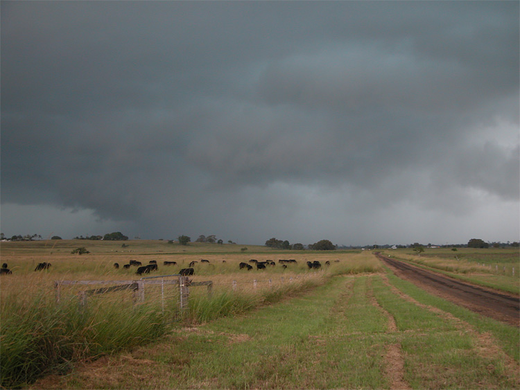
Activity showing on radar WNW of Grafton at 2pm was to be the storm which would develop and head towards the Lismore area. Dave Ellem came over to my place then we picked up Ray Mullens at Goonellabah around 2.30pm. A lot of cumulus had developed locally and was blocking views to the south and south-west. We stopped at the lookout at Parrots Nest south of Lismore and waited. There was some distant lightning but hardly any storm structure due to the blocking cloud.
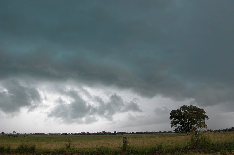
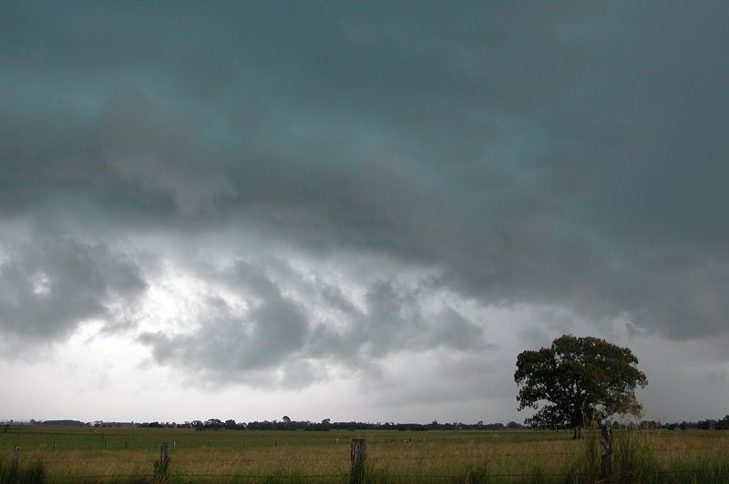
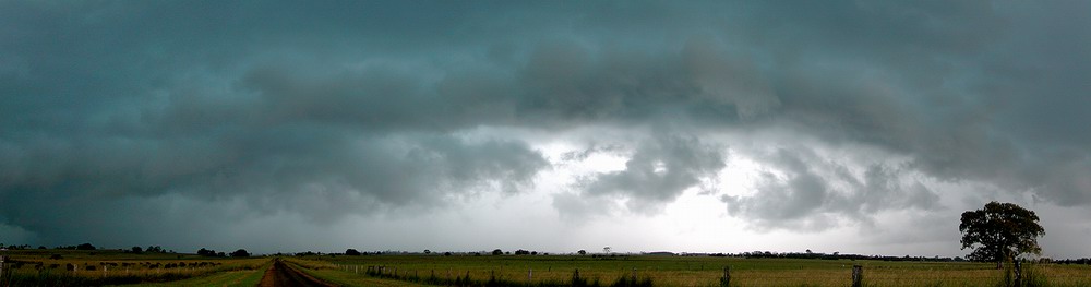
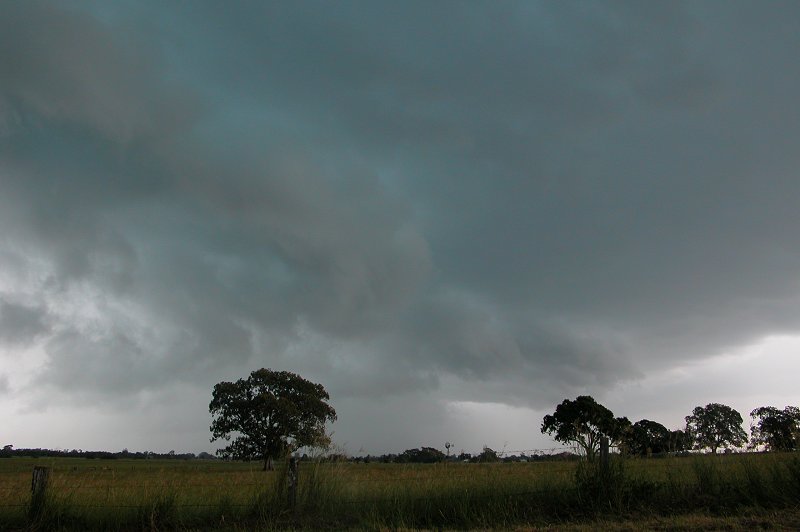
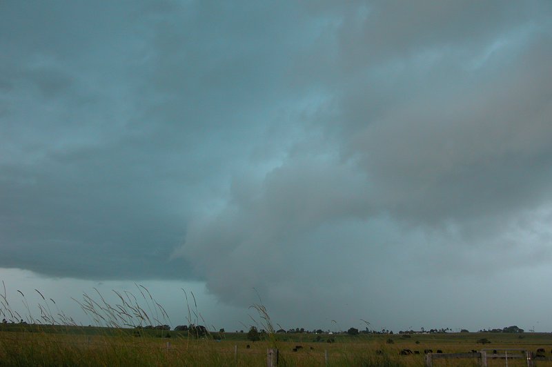
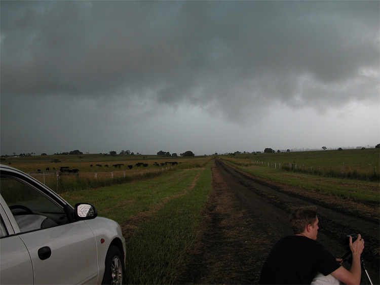
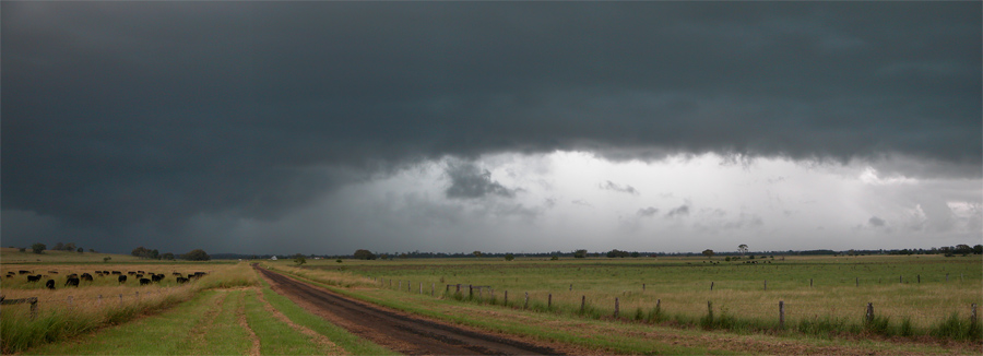
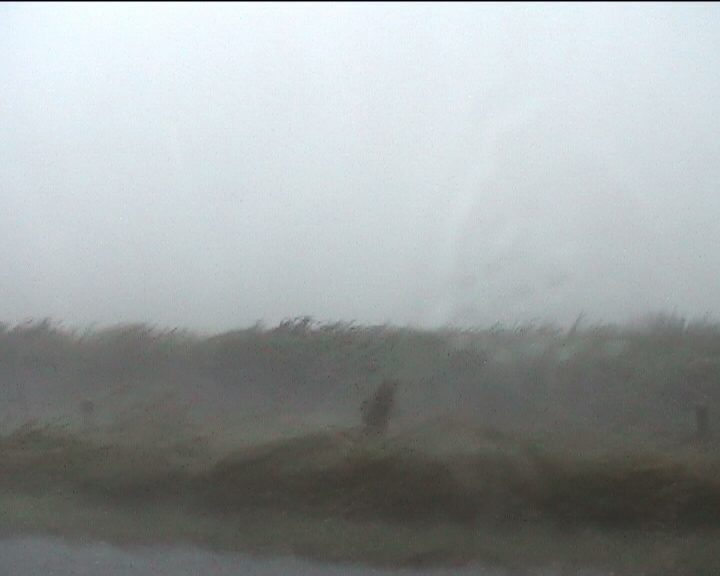
After about 40 minutes we got impatient and headed west a bit further to Fig Tree Lane at McKees Hill for a different perspective. As soon as we got there some distant base features were apparent, but it also looked like the main activity may move towards the Coraki area. We headed back east to Parrots Nest and stopped to check the situation. A barrage of spectacular CGs occurred to our south, but they were still about 25 km away. Base features were now much more apparent and it looked like the core of the storm was heading for halfway between Lismore and Casino, so we headed back to McKees Hill again. We arrived at 4pm, but some anvil rain from another storm to our west made photography frustrating. We stayed at this location as the storm advanced towards us (a NNE heading). CGs were still occurring but less frequent than before, but the base structure had become very interesting. A large gust front feature developed and quickly advanced. It wasn't long before we had to decide whether to stay put or head into where we suspected the core would go.
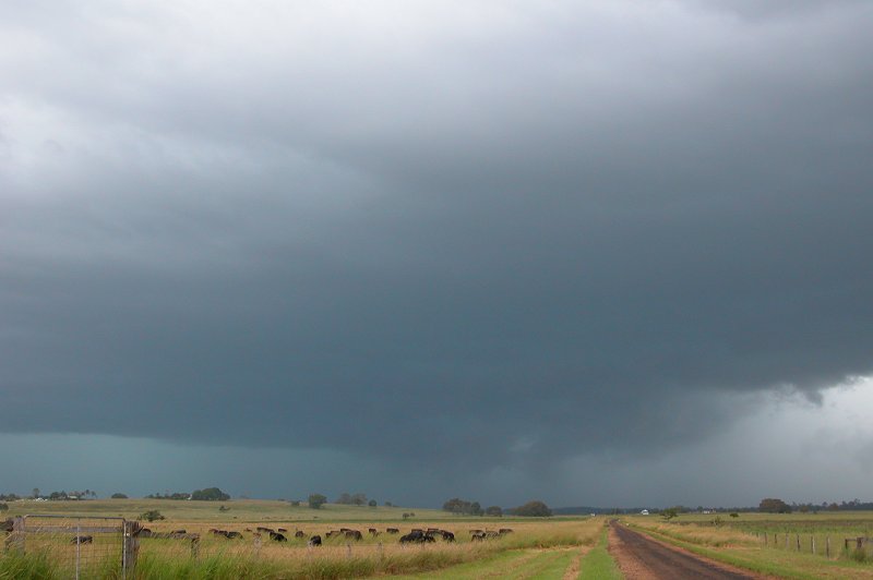
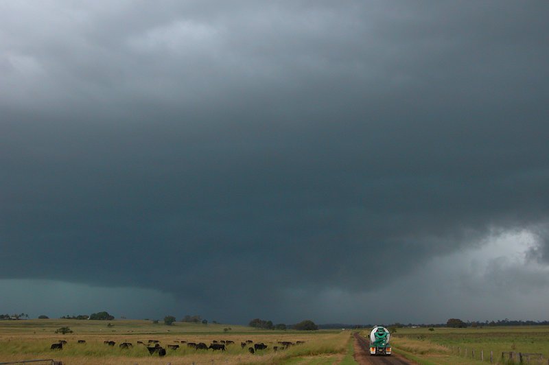
These 5 photos by Ray Mullens
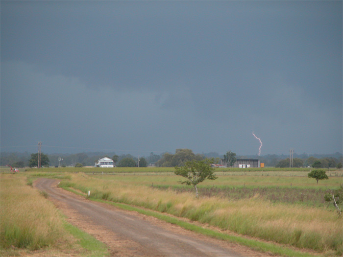
We left Fig Tree Lane and as we turned east into the Bruxner Highway an awesome CG hit right where we had been ! Hundreds of birds in the cow fields went berserk in its wake - it was a very amusing and exciting moment on the chase.
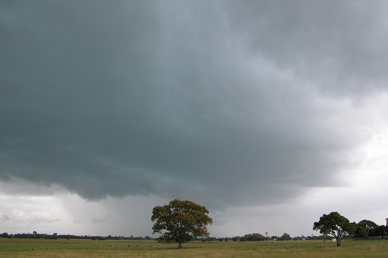
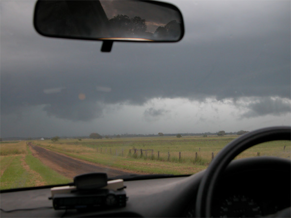
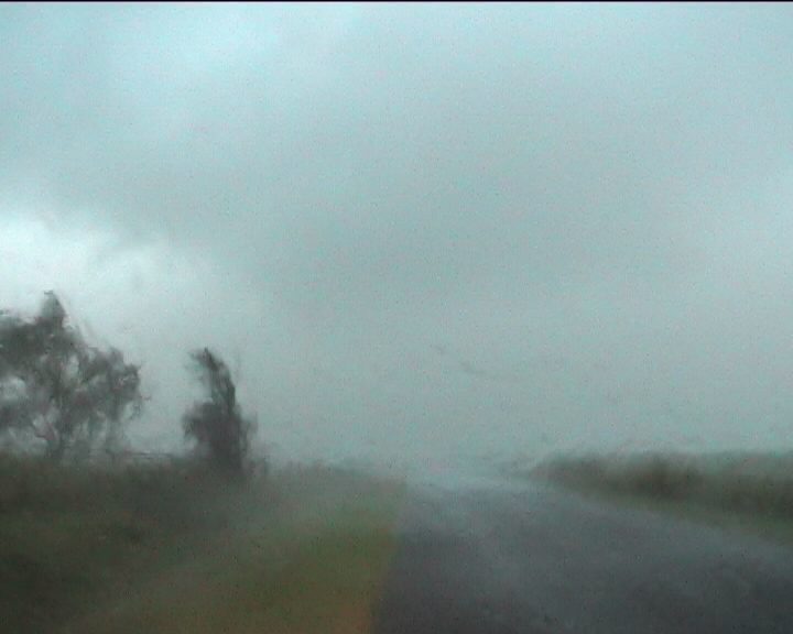
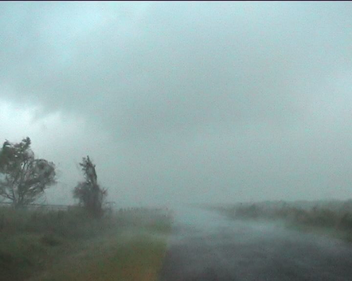
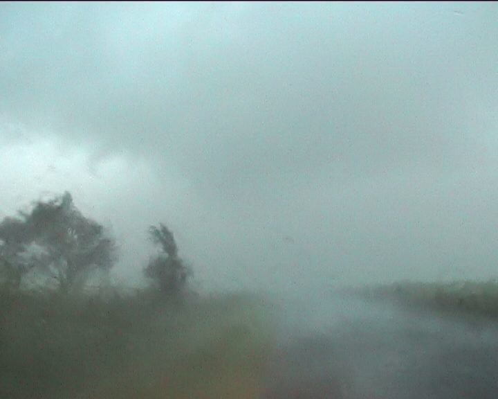
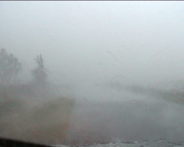
The intense precipitation area was now just to our south. CGs continued to hit nearby as we turned SE into Tatham Road a few ks south of Parrots Nest. The narrow road was clear of large trees and a good location to ride out the storm. We stopped and prepared for it to hit.
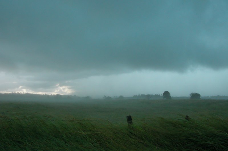
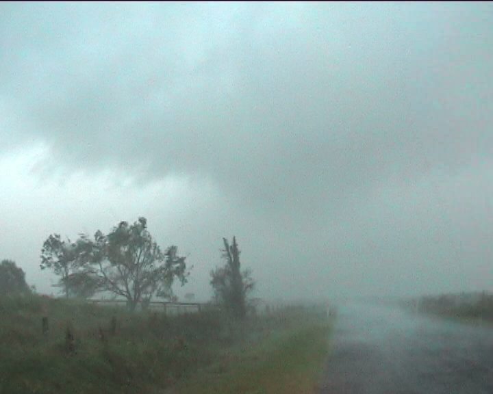
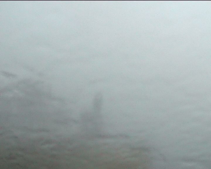
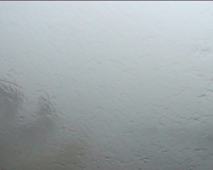
Torrents of violently blown rain hit from the S to SE. It was incredible, though just kept getting more and more intense ! The car was being rocked by the gusts more than I can ever remember before. A couple of small hail stones hit the car, but apparently a lot more 1 to 2 cm stones fell south and west of our location. Some very close CGs hit in the fields near us and the rain just coming and coming. I estimate the rain rate would have been around 200mm per hour, with winds 90 to 100 km/h. It was awesome !


Video clip of a close CG and chaser reactions [16 seconds - 731kb WMV]
Video clip of base structure and initial intense rain and strong winds [66 seconds - 2.73mb WMV]
Video clip of violent winds and incredible rainfall [77 seconds - 3.27mb WMV]
After about 20 minutes we left this location and got back onto the Bruxner Highway. It looked like a parking lot with all the cars stopped by the side of the road waiting for the storm to pass. But they were sitting under large gum trees, how stupid ! Large branches had been brought down right next to them.....
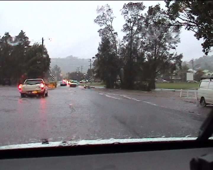
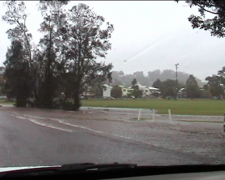
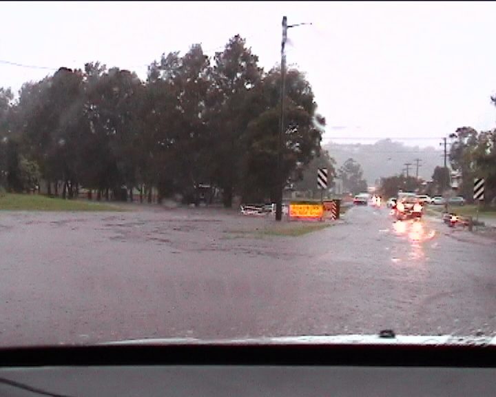
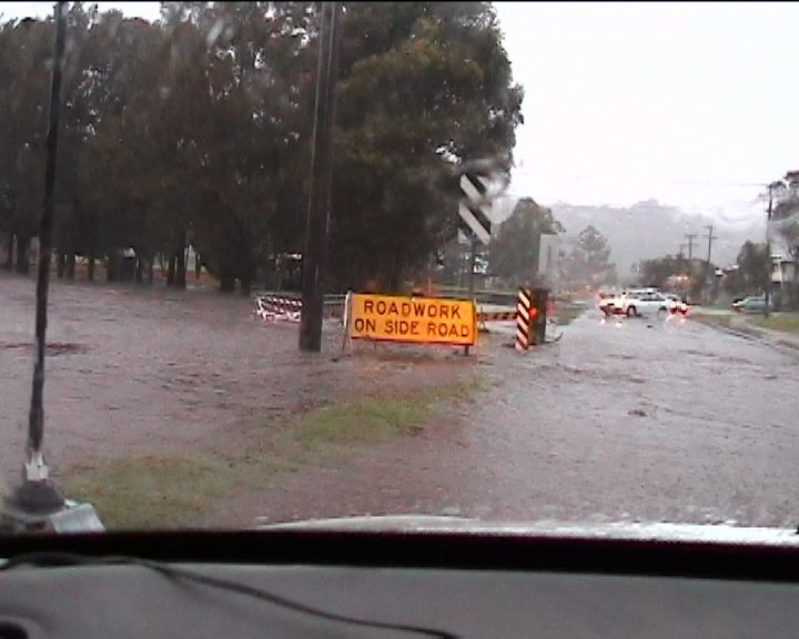
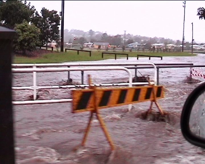
We drove slowly north in torrential wind blown rain, and stopped just near the Lismore Airport. The rain again got intense and persisted for what seemed like ages. Local flash flooding in Lismore itself was looking likely. Sure enough, the gutters and parts of the roadway on the highway into Lismore were awash. Properties and fields adjacent to the road also had water running everywhere or were completely covered in flood waters. Browns Creek which runs through the middle of Lismore was very fast flowing and topping its banks in places. We drove across a bridge near Lismore Shopping Square where the water was about 20cm deep across the road.
Video clip of flash flooding in Browns Creek, Lismore [36 seconds - 1.54mb WMV]
Close lightning and rain persisted into the evening after this large probable HP supercell continued further north. The storm hit Murwillumbah about 6pm and caused significant damage there. Many homes were completely unroofed, and numerous large trees and powerlines were brought down. The NSW State Emergency Service received 87 calls for assistance.
From Bureau of Meteorology.
From Bureau of Meteorology.
21z to 10z animation
From Bureau of Meteorology.
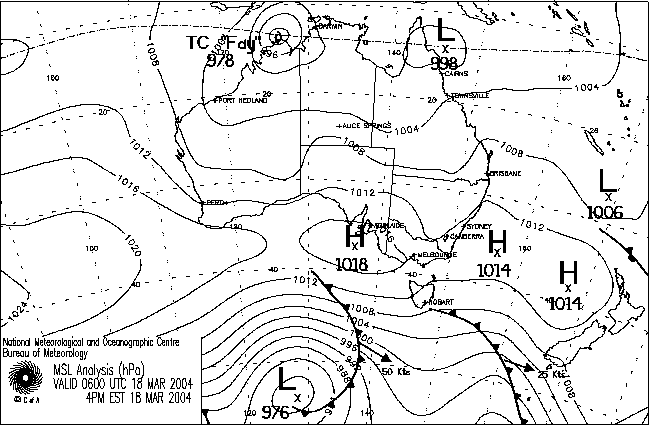
From NOAA 18/03/2004 06z analysis run
|
Document: 200403-02.htm
Updated: 6th September 2005 |
[Australian Severe Weather index] [Copyright Notice] [Email Contacts] [Search This Site] |