and Chasing
[Index][Archives]
NSW North Coast Supercell and Hailstorm: Tuesday 31st December 1996
by Michael Bath
| Storm News and Chasing [Index][Archives] |
NSW North Coast Supercell and Hailstorm: Tuesday 31st December 1996 by Michael Bath |
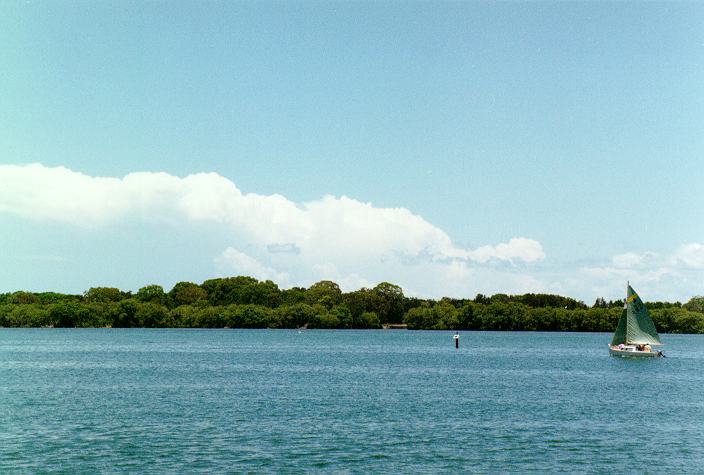
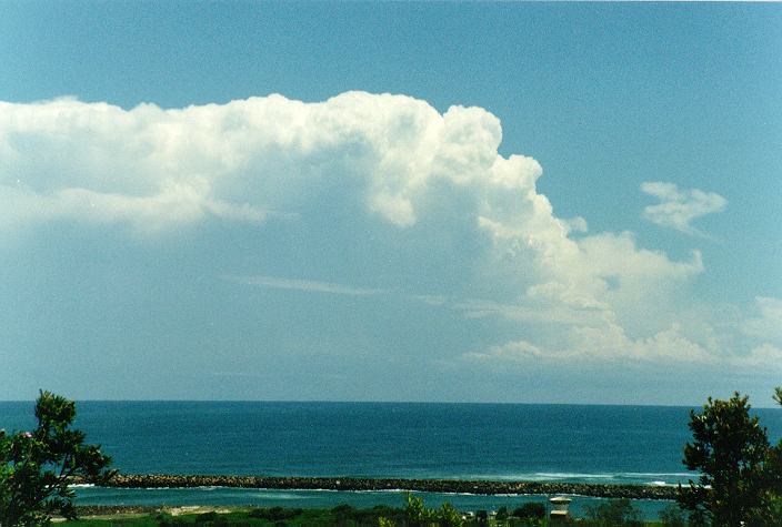
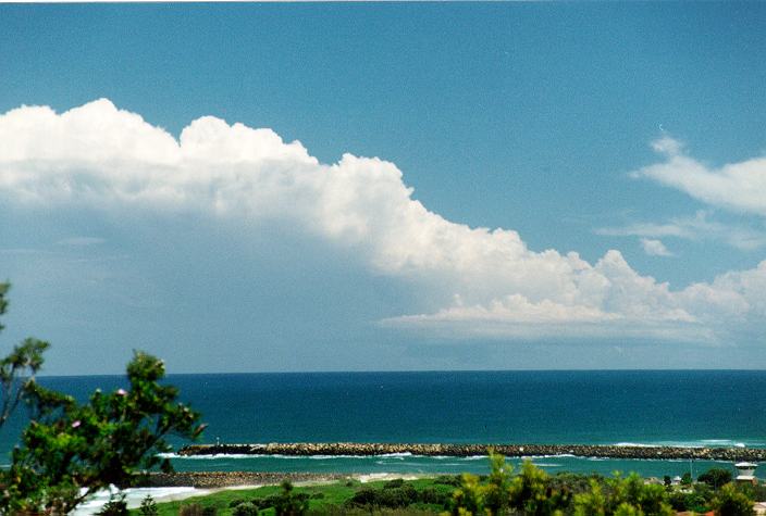
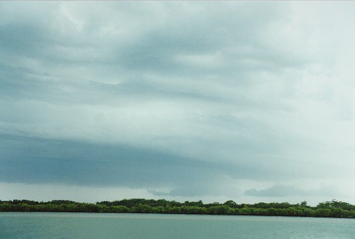
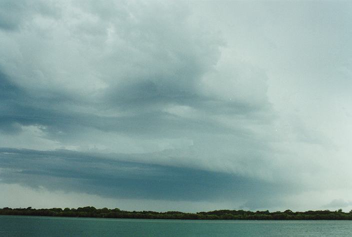
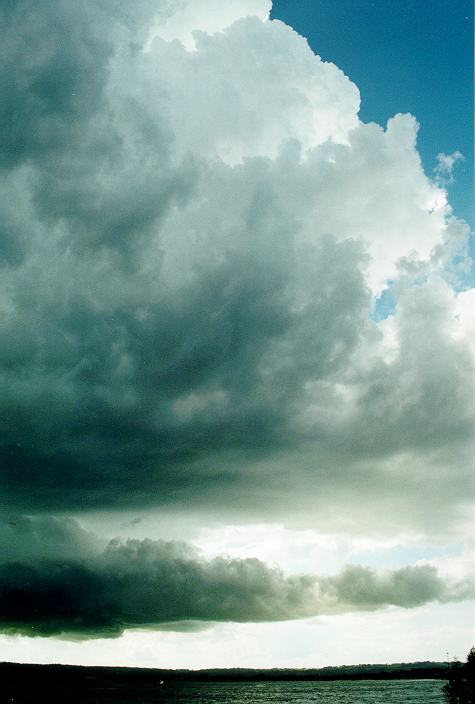
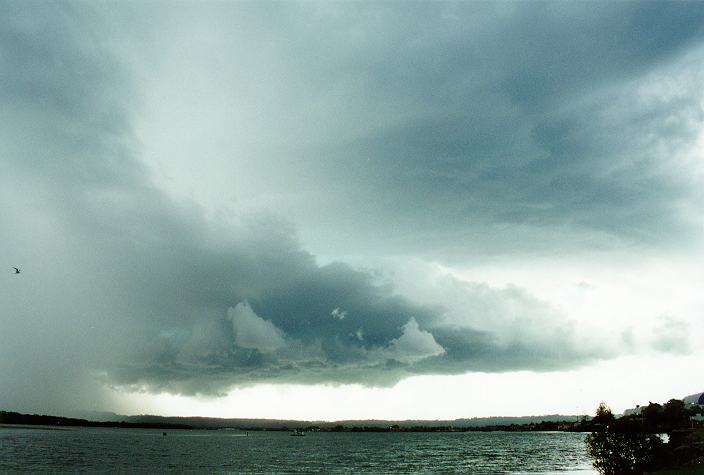
I later moved to the lookout at East Ballina. This storm had supercell structure and was quite a long way away. I estimate that it developed near Yamba (50km south) and was then out to sea for the duration of my observations. A wall cloud caught my attention by 1.45pm - and became quite distinct as it grew larger. I observed at least two tornadoes/water spouts under the wall cloud - though they were very small due to the distance. The wall cloud developed in the north-west flank of the storm.
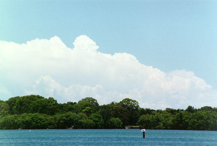
At about the same time a storm became organised, though it was not huge, over Lismore to the west. It tracked to the north-east towards Nimbin, where some damage from lightning strikes occurred. I was unable to give chase, and in hindsight I'm glad that I didn't as I would have missed the supercell out to sea. This storm dissipated by 3.30pm to the distant north, and at no time had any spectacular features or indications of severity, although extensive mamatus was observed.
Back at my parents place in Ballina, I kept a watch for any further development, though between 3 and 4pm not much happened - there were weak cells about and plenty of congestus, but nothing worthy of a photograph.
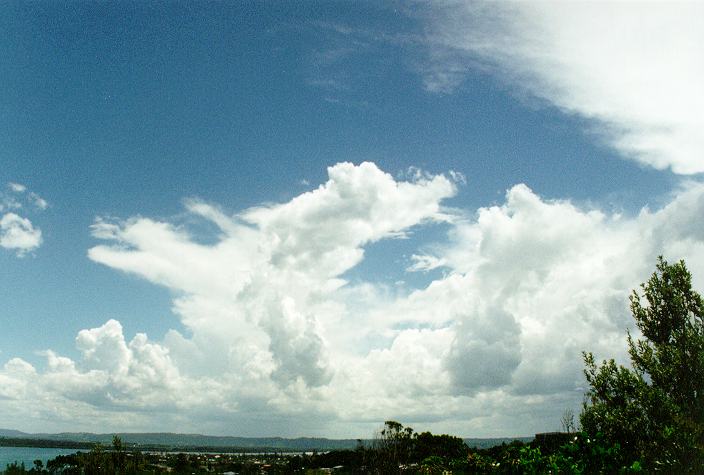
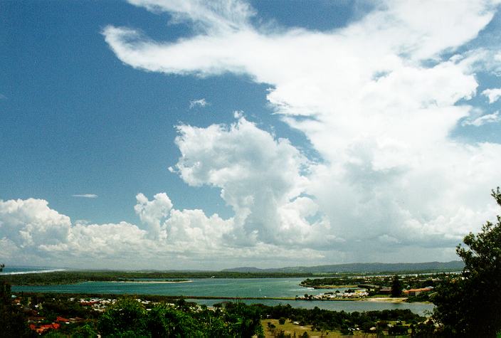
Soon after 4pm my attention turned to the south south-west, not far from town - probably just 15km away. Rapid cumulonimbus development was occurring, so I headed for a vantage point beside the Richmond River.
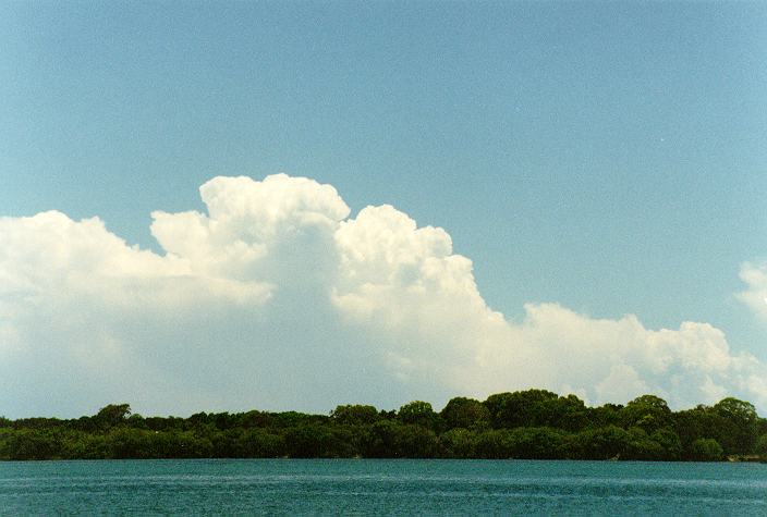
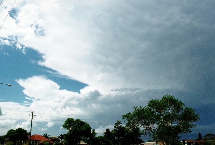
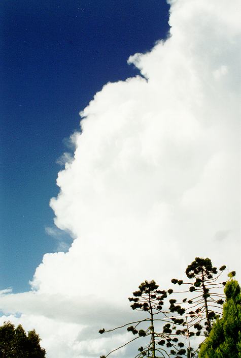
Two cumulonimbus towers grew very quickly into large and spectacular storms. The first, directly to the south, developed a very low base, shelf cloud and green tinge. This spread north-eastwards away from town, but gave heavy precipitation and a lot of lightning to South Ballina.
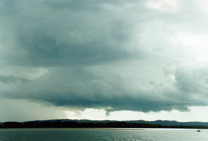
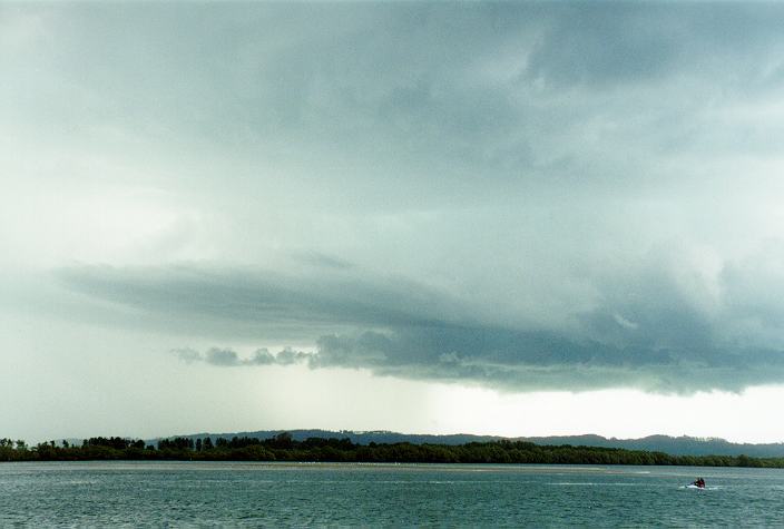
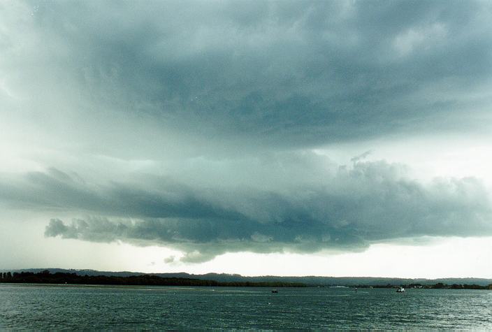
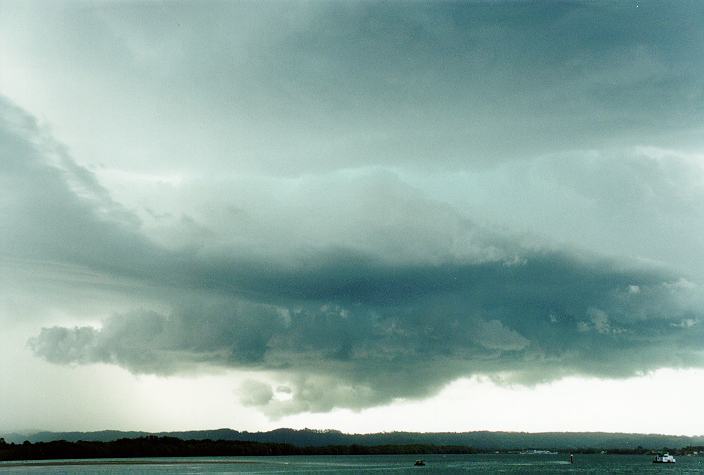
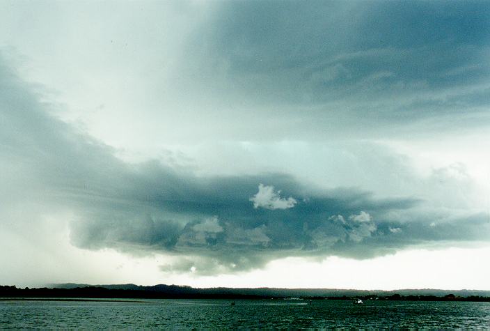
The second cell became the focus of attention from 4.40pm. Explosive development occurred on the boundary between the outflow of the first storm and the moist low level flow (visible in the form of status) from the north-east. It was amazing to watch the cloud rise so high from such a close location. A lowered base developed within 10 minutes and an incredible green colour separated the lowered section from the main cell base. Scuds and wisps of other cloud swirled underneath, although there was no indication of base rotation. In the next few minutes another lowered section developed beneath the first lowered base - probably down to within 100 metres of the ground !. The storm was now only a couple of kilometres away to the south-southwest. Precipitation was quickly spreading towards the town centre.
At 5.02pm I made a dash for home as the first few drops of rain fell. Rounding the first street corner a (slightly) unexpected but familiar sound was heard on the car, but dismissed as something else. Moments later a second sound, then again - HAIL ! Unusual for Ballina - it is not a hail prone area. Only 1 - 1.5cm stones fell but it was enough to freak everyone out. Moderate rain fell for about 15 minutes with the hail tapering off after about 10 minutes. From the structure of the storm, I would anticipate that larger hail would have fallen - anywhere between here and Alstonville 10km to the west. A report of 3cm hail was later received from Knockrow, 10km north of Ballina.
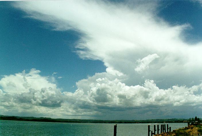
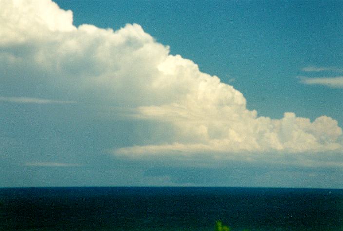
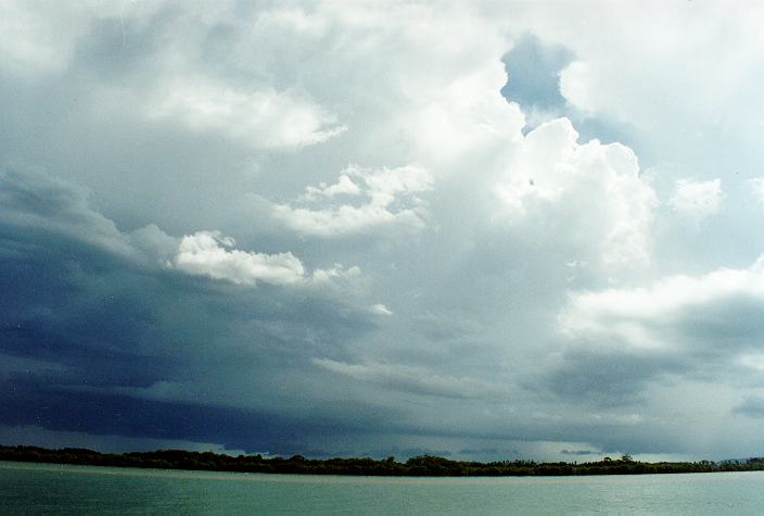
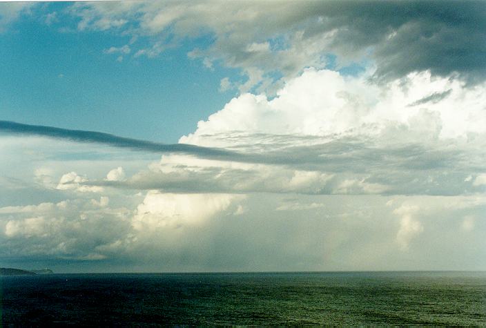
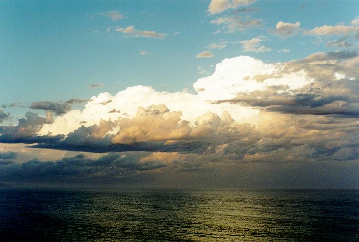
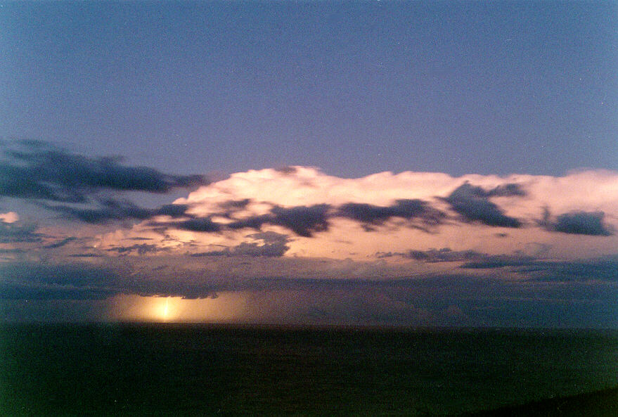
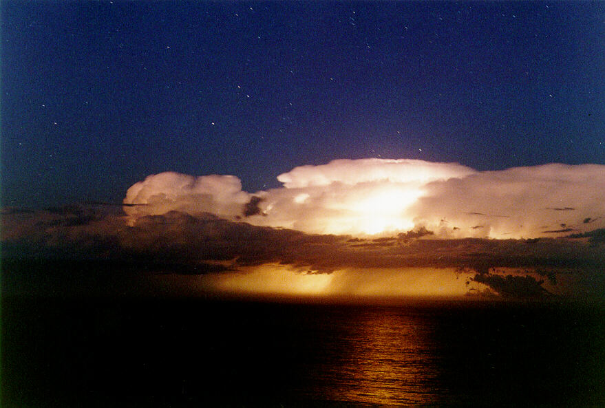
As the storm passed to the north-east its enormous height became apparent - a wall of cloud billowed 15 kilometres into the sky - brilliantly illuminated by the sun. The storm slowly moved north-east and crossed the coast between here and Byron Bay. It maintained its general position (about 30 - 40km out to sea from Cape Byron) for many hours, initiating new updrafts on the western flank. As the sun set a fantastic lightning show was observed from Lennox Head lookout (10km north of Ballina), giving some great photo opportunities. A surge of southerly air with a little stratocumulus threatened to spoil the show but fortunately it did not reach very far. However the southerly did manage to activate some stagnant congestus over Ballina. While driving into Ballina at 9pm it began to rain and the odd flash of lightning was seen. By 9.30pm torrential rain was falling and lightning was crashing around. The rain lasted for nearly an hour and gave about 40mm
|
Document: 9612-06.htm
Updated: 7th April, 2004 |
[Australian Severe Weather index] [Copyright Notice] [Email Contacts] [Search This Site] |