and Chasing
[Index][Archives]
The Northwestern Sydney Severe Thunderstorm with Microburst: Monday 27th October 1997
by Jimmy Deguara
| Storm News and Chasing [Index][Archives] |
The Northwestern Sydney Severe Thunderstorm with Microburst: Monday 27th October 1997 by Jimmy Deguara |
Large cumulus began to develop around mid-morning.
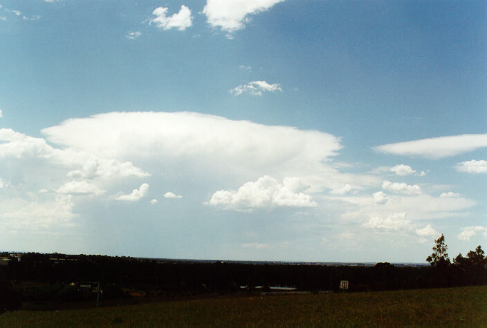
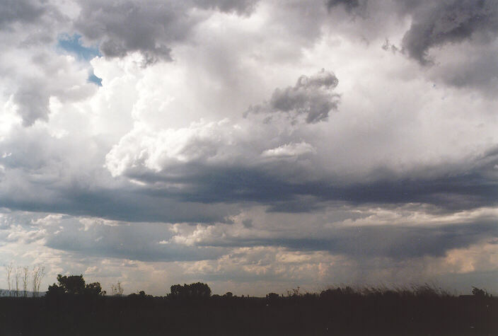
 Towards the north, a more developed cumulus began to grow and gradually developed into a thunderstorm with beautiful "crisp" tops. It continued to develop with a back-sheared anvil by noon.
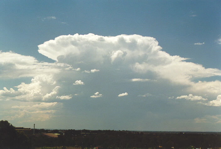
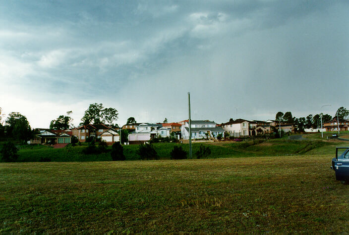
Another cumulus cluster developed to the southwest and west of St Marys. At about 2pm, these developed further and dominated. I had not observed this situation for many years. 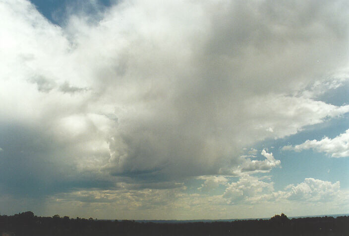 The developing anvil seemed to be dissipating but actually continued to spread out and thicken. (A similar situation occurred in a severe hailstorm outbreak September 1983). It was then that I was convinced this may produce hail. I decided to phone Michael only to leave a short obvious message on the answering machine. It then occurred to me he may be at home. After phoning his home, I was astonished to find not only had he arrived home, he had already left for an observation session. My guess was that it was on Rooty Hill.
I headed for Rooty Hill. He suggested we drop his car off and chase in the one car. After doing this, we decided against going back to Rooty Hill and headed through Mt Druitt and then St Marys. Storms had become very active by this stage and I believe was already producing hail. Our decision was to chase on the northern side which should give us the best view and best chances of good, high-contrast photographic opportunities.
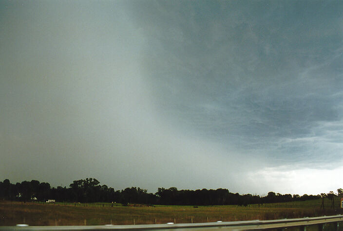
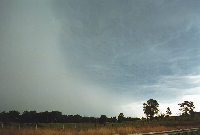
We then headed down the M4 exiting near Glenmore Park. We were greeted with magnificent rain curtains and dark boiling bases with a light green tinge. We drove into the estate only to find a dead end. This meant that the storm would gradually edge closer and we would experience wind squalls with possible hail. 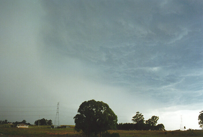
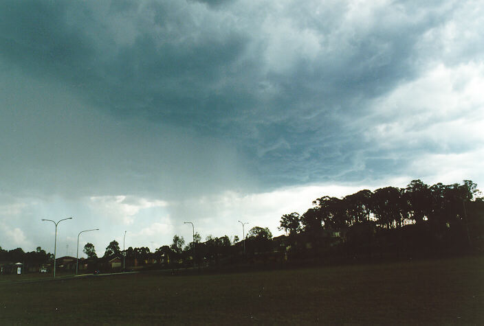
 After a short stop and a couple of quick "snaps", we headed out back onto the Northern Road, the M4 and west after experiencing strong winds and large drops of rain. We took the next exit onto Mulgoa Road. We stopped in a park below the spectacular, high contrast boiling bases. The storm was relatively narrow but stretched from north to south. Development continued to the south. We could just make out the back-sheared anvil spreading out westward.
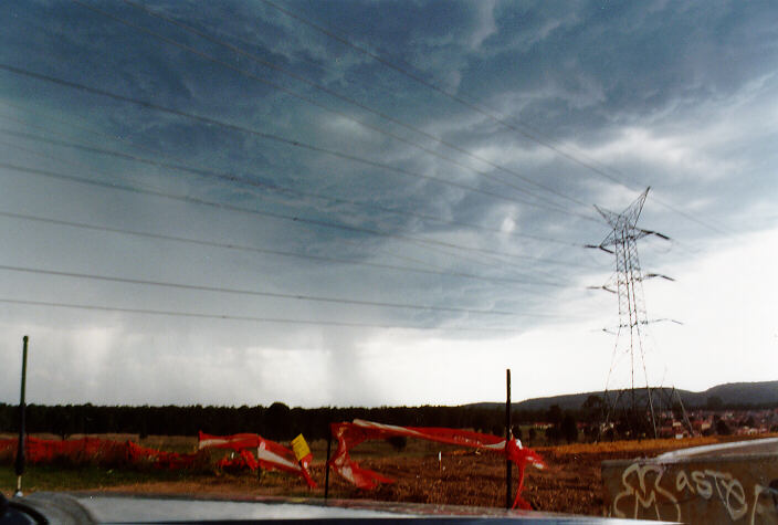
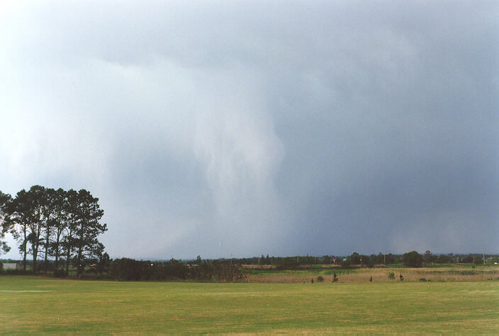
After a few photographs of the curtain and indications of microbursts, my attention suddenly directed to a circulation overhead. I took a photograph of it and Michael also took some video footage.
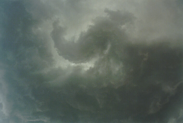
 This circulation was only brief but still encouraging.
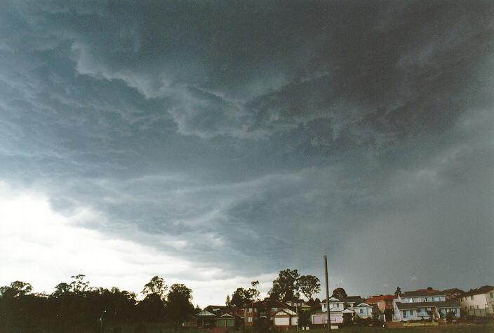
For a chance of better action, we headed north toward Castlereagh. We took another photograph of the edge of the rain curtain spreading out to the north indicating more microbursts. We were desperately trying to catch the storm by criss-crossing the countryside. But again, the road network simply did not allow us to get there in time so, after passing through steady rain with large drops moving east up to Shane Park, we headed north again for Windsor.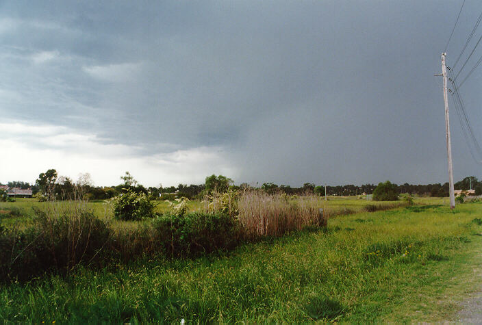
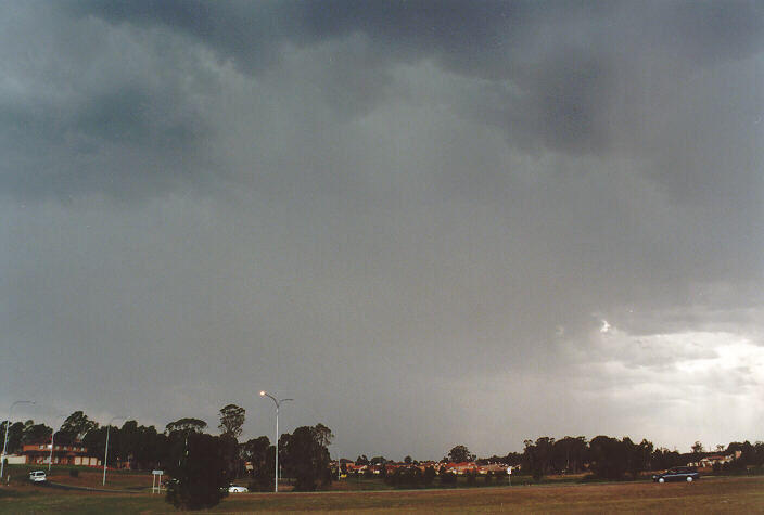
At Windsor, we observed the main storm move to the northeast. It was producing a fresh downdraught despite the storm being at least 15 kilometres away. This downdraught continued for at least half an hour or so.

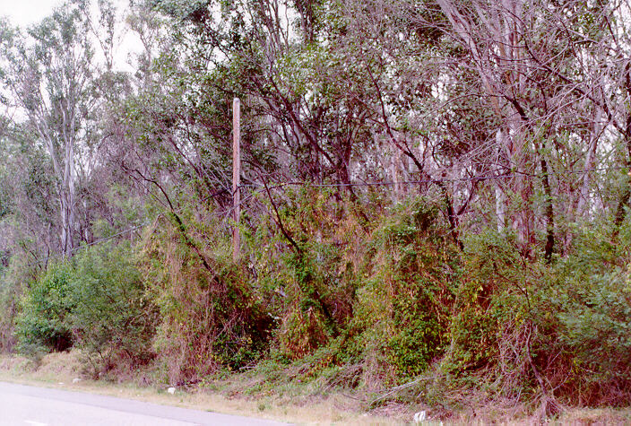
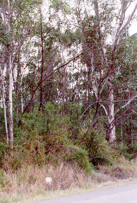
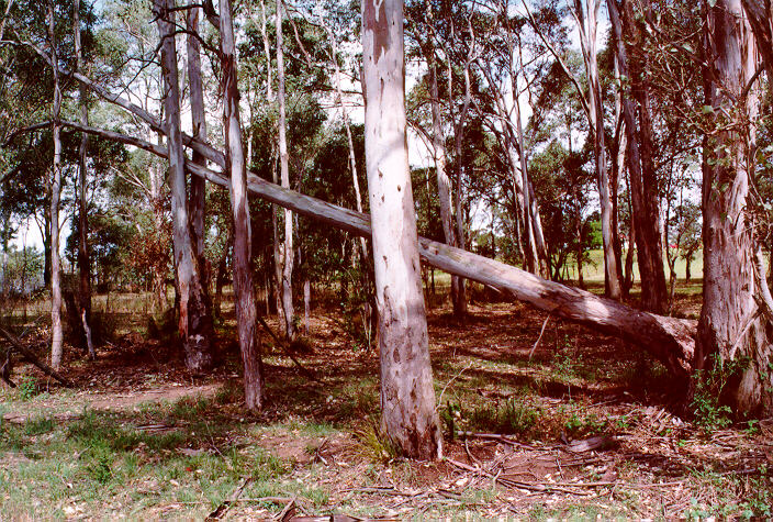
From a vantage point at Freemans Reach near Windsor, weaker storms with moderate heights began to slowly develop from cumulus clusters to the southwest. After watching these further develop, we decided to travel along Windsor Road to observe some interesting base features and the heavy rain. On the way, Michael and I observed broken branches varying in size and some smaller branches entangled in the power lines. People were cleaning up. The storm had passed through the Box Hill and Rouse Hill region earlier. We passed through some local heavy falls around Parklea and headed home.
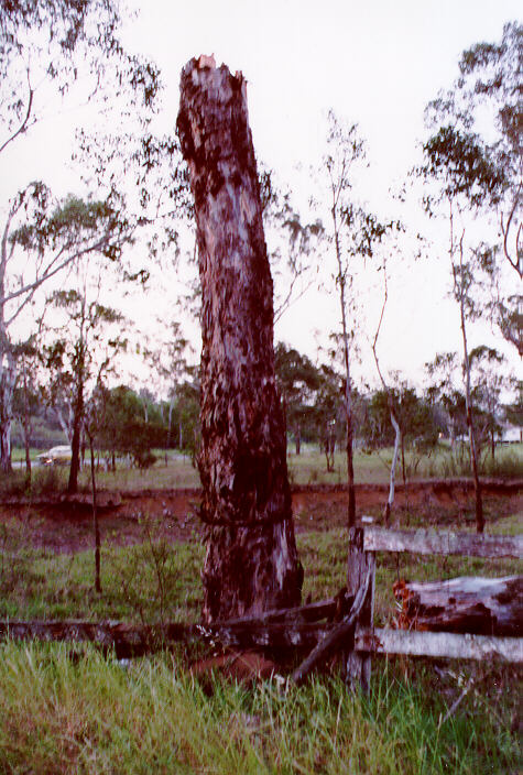
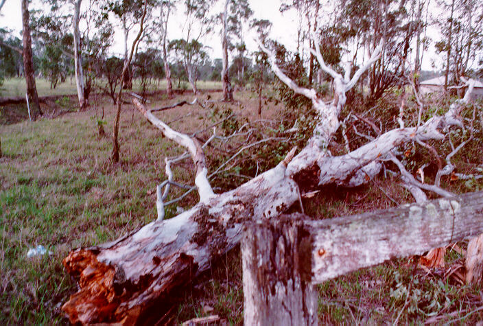
Damage from this storm at Schofields, Riverstone, Rouse Hill and Box Hill was indicative of microbursts. Although it seemed isolated, there were several indicators that suggest this storm was severe.
The types of damage indicate a sudden squall.
Of course, if anyone has photographs, video footage, newspaper articles or information and accounts about this storm (or any storm) and would like to send it along, we would very much appreciate it.
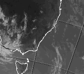
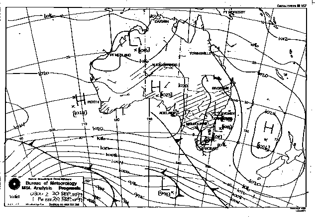
These images obtained from the Bureau of Meteorology

|
Document: 9710-01.htm
Updated: 5th May, 2005 |
[Australian Severe Weather index] [Copyright Notice] [Email Contacts] [Search This Site] |