and Chasing
[Index][Archives]
NSW North Coast Storm Chase (Evans Head cell): Friday 31st December 1999
by Michael Bath
| Storm News and Chasing [Index][Archives] |
NSW North Coast Storm Chase (Evans Head cell): Friday 31st December 1999 by Michael Bath |
31/12/99 4.17pm Aussie Weather email update by Halden Boyd
There are a few cells around here at the moment but at this point nothing looks very significant... I hear a few muffled rumbles from a cell which is building to the SW as I speak... perhaps later on this evening. The LI and CAPE are looking good tomorrow afternoon between the Gold Coast and the Sunshine Coast so there could be some action there.
31/12/99 5.32pm Aussie Weather email update by Anthony Cornelius
Michael Bath is out chasing in NE NSW at the moment, the BoM issued a severe thunderstorm advice for his target area at 1354 EDT. He's been chasing what he believes to be a severe multicell thunderstorm - it's lasted for about two or so hours now - MB has said it doesn't look like a supercell... rather a line of multicells with its strongest edge on the northern side - of which radar confirms. He believes this will definately have hail (yay Jimmy!!).
He's quite impressed and happy though from the tone of his voice on the phone!
I'll keep everyone updated when possible - the storm appears to be heading for Evans Head - currently, it's certainly the strongest cell on radar - with some smaller and weaker cells to its south.
Just got back from a chase of the Evans Head cell which hit the village at 5.55pm EDST. Liaised at home with Michael Bath who positioned himself at Woodburn with radar updates. Ventured out at 5pm to the local airport to get a clear view. Beautiful culiform anvils (three of them) which merged as they headed upwards... about 30km across and being fed by strong cumulus tops about 4500 feet from the ENE. An outflow appeared to the SSW heading towards Woodburn with a nice shelf cloud to the SE of it. There appeared to be a small gustnado. Best mammatus I have seen for some time ahead of it with lightning occasionally snaking to the ground in it. Sped off towards Woodburn... didn't make it to Woodburn... bugged Michael heaps on the mobile (sorry mate) as the cell suddenly appeared to turn back towards Evans Head. I turned around and just overtook it and got a great shot of it (shelf cloud) as the rain hit Evans Head! Tookoff ahead of it to the local lookout... leaves swirling everywhere but basically being pushed by the strong SW outflow. I was doing 80km/hr and just keeping pace with... lucky there were no cops around because it is a 50K zone!! Made the lookout as the 50 knot SE hit. Did a shot through the car windscreen before white out. Hail for 5 minutes pea sized but not intense. Fair bit of lightning too. Crawled home for cover. The rain has just stopped at 6.22pm. Rainfall 17mm. A good sharp storm... and covered from the east and the west thanks to Michael Bath!!
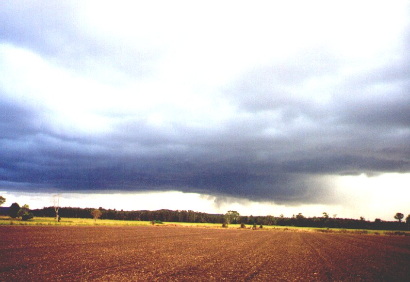
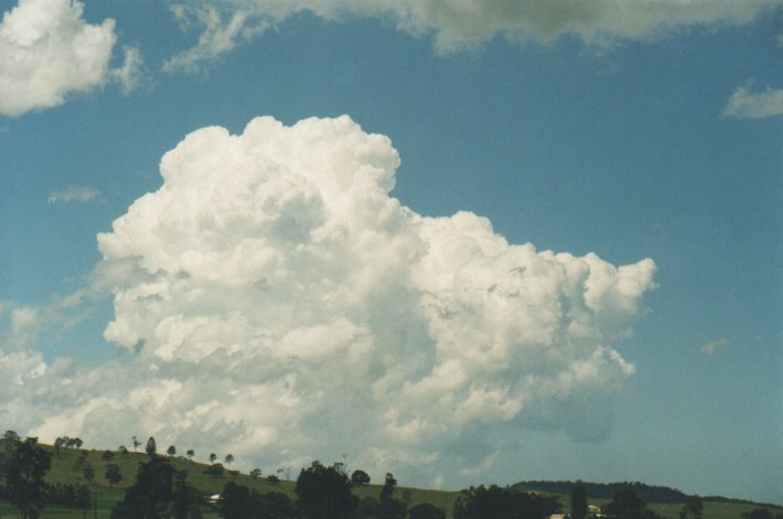
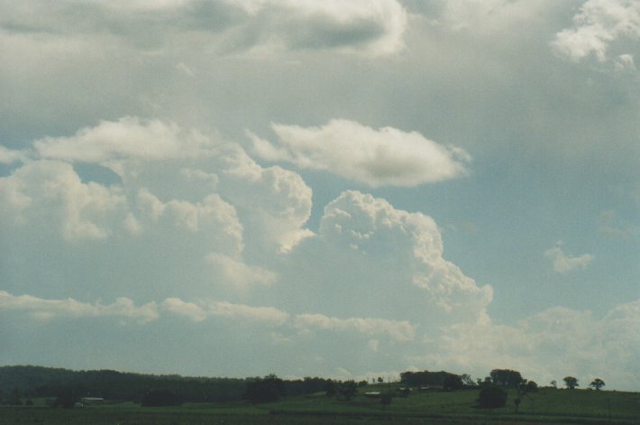
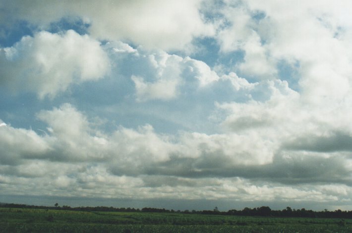
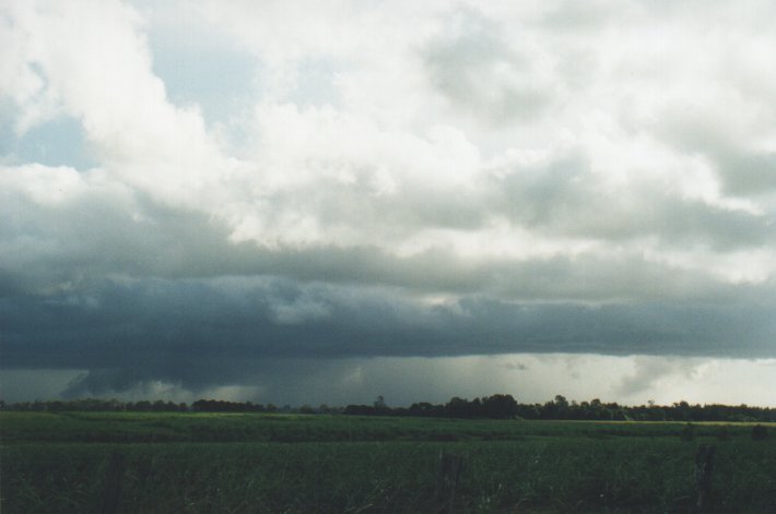
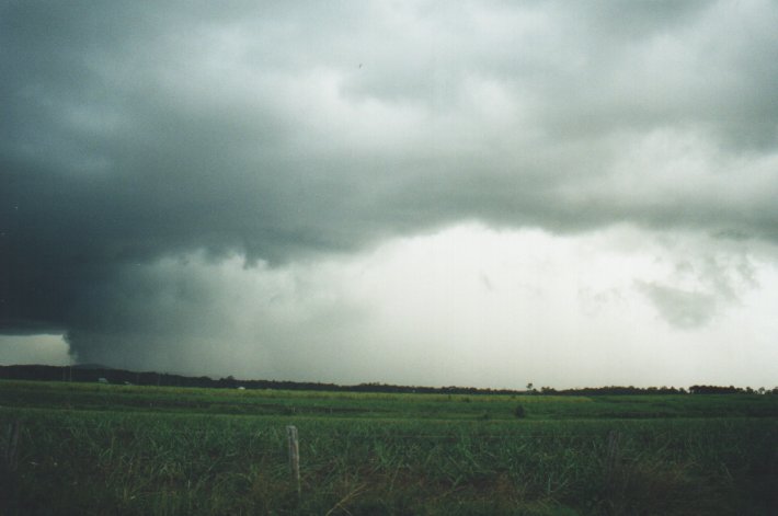
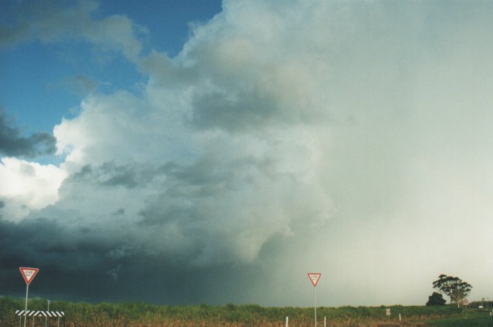
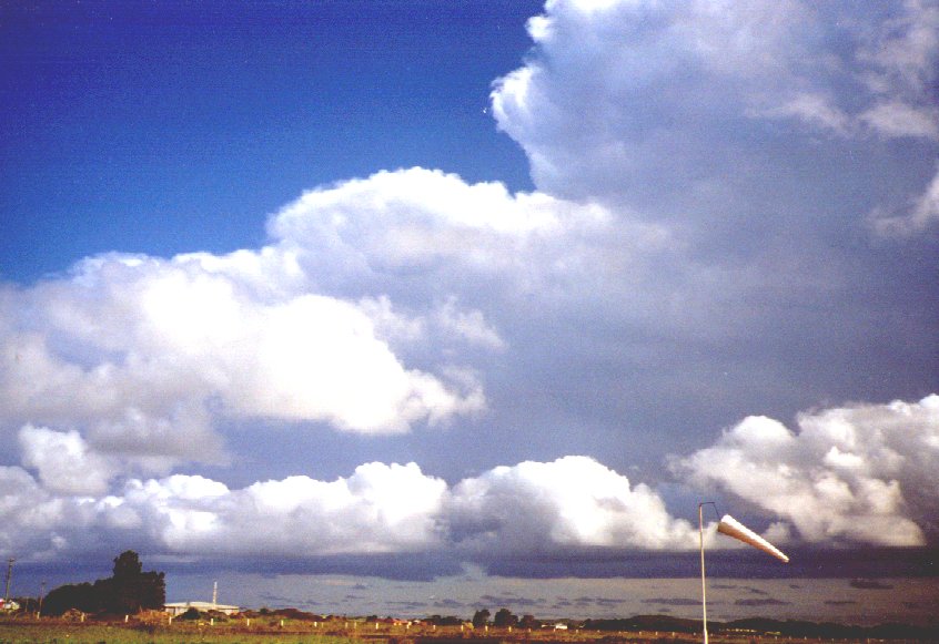 Evans Head Airport 5pm looking southeast. Big inflow of stratocumulus from ENE tops approximately 4500 feet. The upper two cells in this picture are clear, but were merging and going to cumliform and towering.
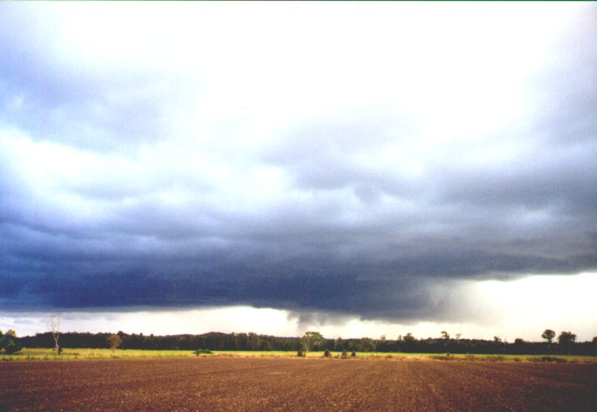
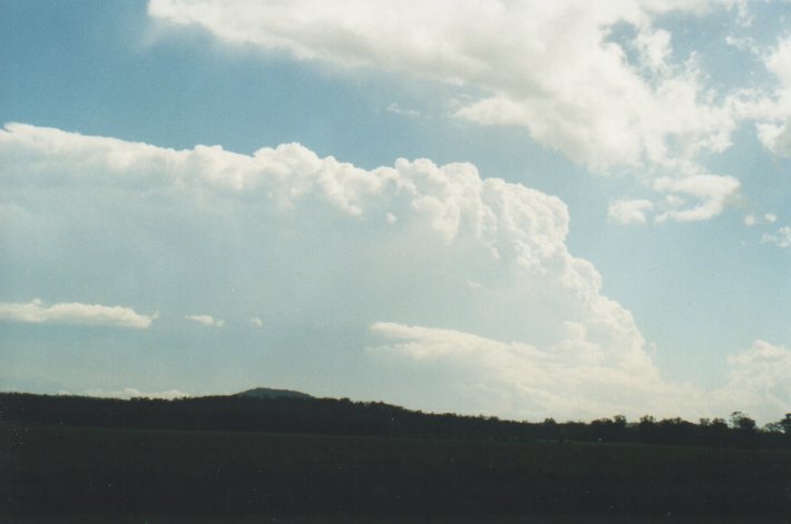
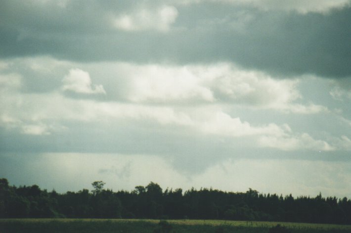
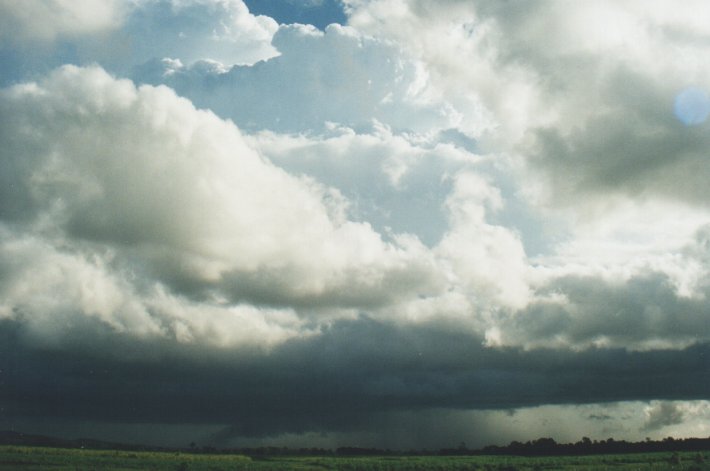
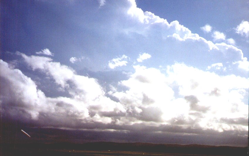 Evans Head Airport 5pm loooking southwest. Big inflow of stratocumulus from ENE tops approximately 4500 feet. The third cell to the rear was starting to interact violently upwards and going full-on into cumliform and there was distinct arcus under it with what appeared to be a small gustnado to the rear. At this point is appeared to be heading NW towards Woodburn.
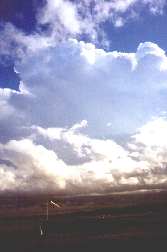
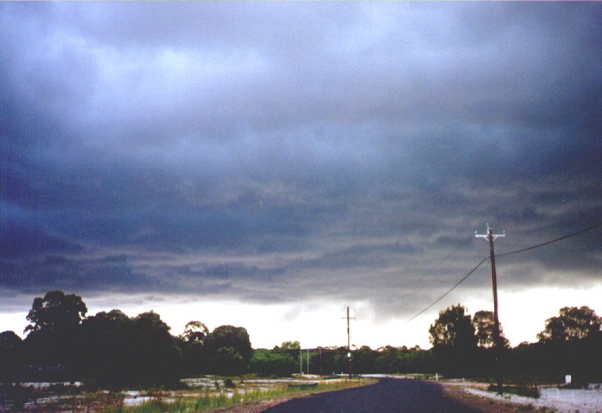
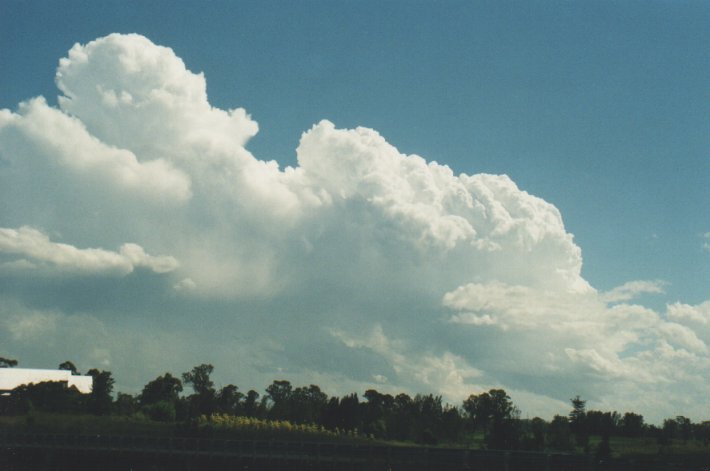
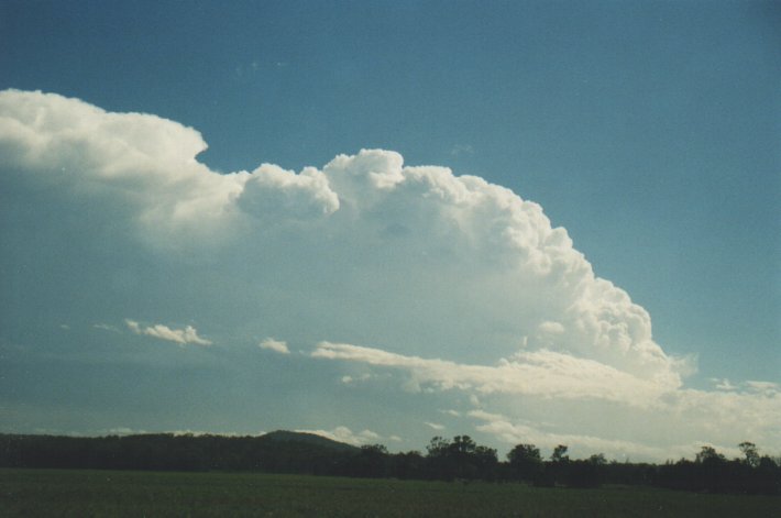
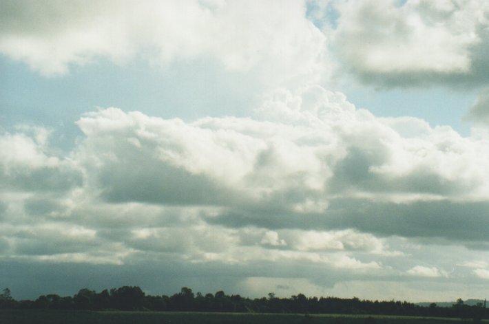
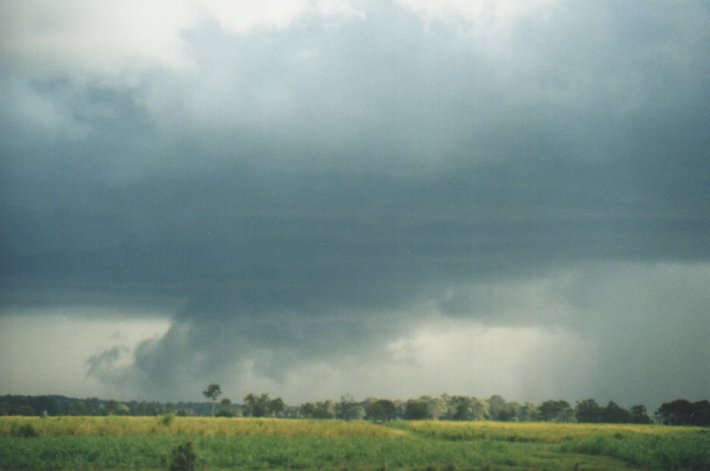
 Rapid development of the cell now and getting black with a distinct arcus and gustnado. Telephoned Michael Bath at Woodburn and said I was heading over as a matter of priority and I would meet him. Time 5.25pm EDST.
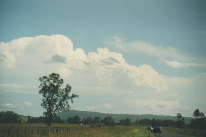
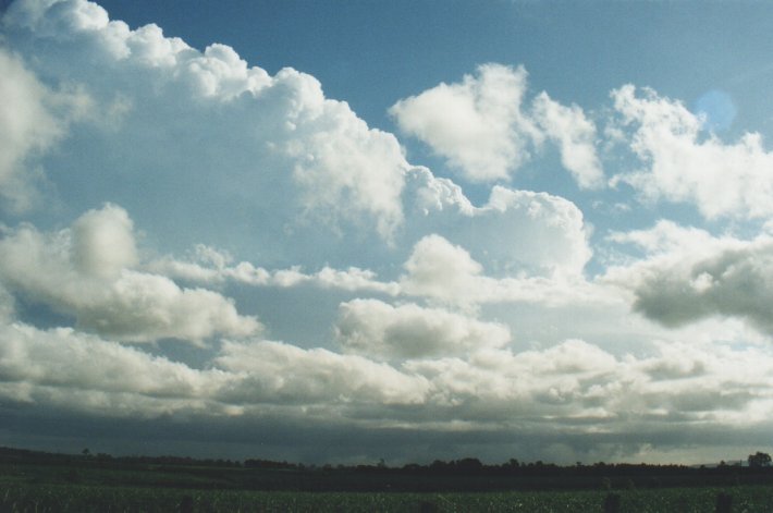
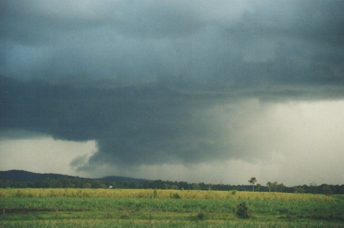
 Stopped the car 2kms east of Woodburn after looking for a cane field clearing. There it was! Spinning violently. I rang Michael and advised him
I was heading back toward Evans Head to chase it. There was a distant snaking gustnado. I waited 2 minutes and took another shot.
Stopped the car 2kms east of Woodburn after looking for a cane field clearing. There it was! Spinning violently. I rang Michael and advised him
I was heading back toward Evans Head to chase it. There was a distant snaking gustnado. I waited 2 minutes and took another shot.
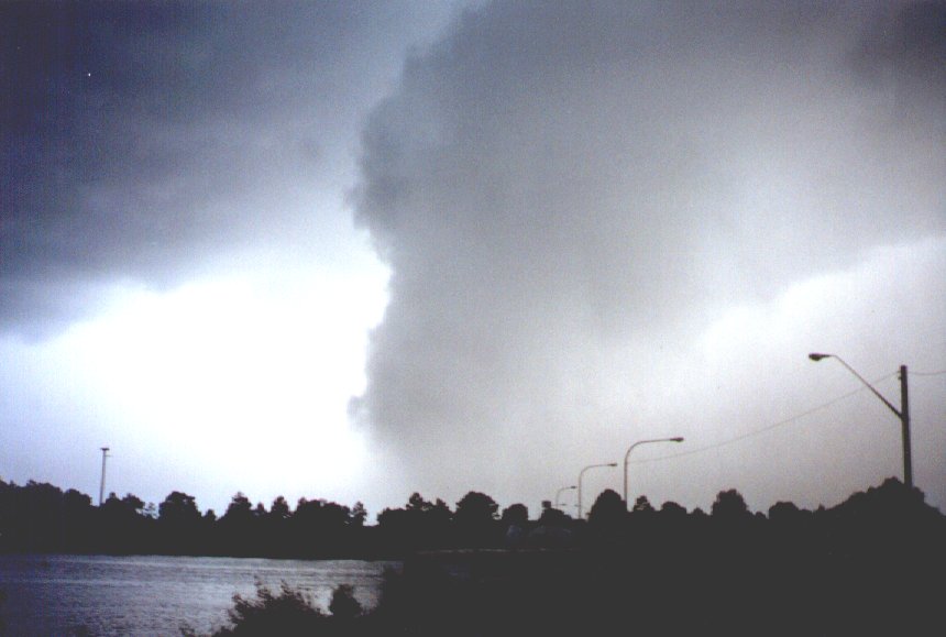
 It was getting closer and I started to worry... phoned Michael again and said I was heading off. He was just about to cop the rain curtain. To
me the gustnado was looking serious and like touching down. I was excited and frightened when I took this shot and headed off. There is a clear gustnado coming out of the mamatus in front of the spinning arcus. Mike asked if there was any place I could take cover.
It was getting closer and I started to worry... phoned Michael again and said I was heading off. He was just about to cop the rain curtain. To
me the gustnado was looking serious and like touching down. I was excited and frightened when I took this shot and headed off. There is a clear gustnado coming out of the mamatus in front of the spinning arcus. Mike asked if there was any place I could take cover.
 Headed east back towards Evans Head and outpaced it. There was a new subdivision 5km west from Evans Head so I shot down the road. Wind started
to pick up... lightning everywhere... the arcus was now rolling under the front... no sign of gustnado now.
Headed east back towards Evans Head and outpaced it. There was a new subdivision 5km west from Evans Head so I shot down the road. Wind started
to pick up... lightning everywhere... the arcus was now rolling under the front... no sign of gustnado now.
 5.55pm at Evans Head bridge looking southeast. The arcus was rolling under and there was heaps of lightning and then I was hit by a wall of
torrential rain. Time to get out of here too. Headed toward the lookout about a kilometre away to the north. Out ran the rain curtain and there were leaves swirling along the road in front of me. I was doing 80km/hr.
5.55pm at Evans Head bridge looking southeast. The arcus was rolling under and there was heaps of lightning and then I was hit by a wall of
torrential rain. Time to get out of here too. Headed toward the lookout about a kilometre away to the north. Out ran the rain curtain and there were leaves swirling along the road in front of me. I was doing 80km/hr.
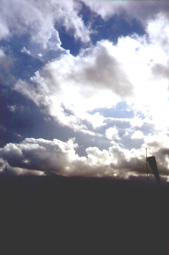
 Arrived at the lookout and there was a whiteout. Hail pea sized lasting 2 minutes. Crawled home... 6.20pm it was all over... 17mm in the gauge.
What a storm it was!
Arrived at the lookout and there was a whiteout. Hail pea sized lasting 2 minutes. Crawled home... 6.20pm it was all over... 17mm in the gauge.
What a storm it was!
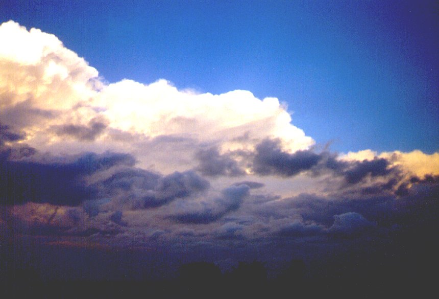
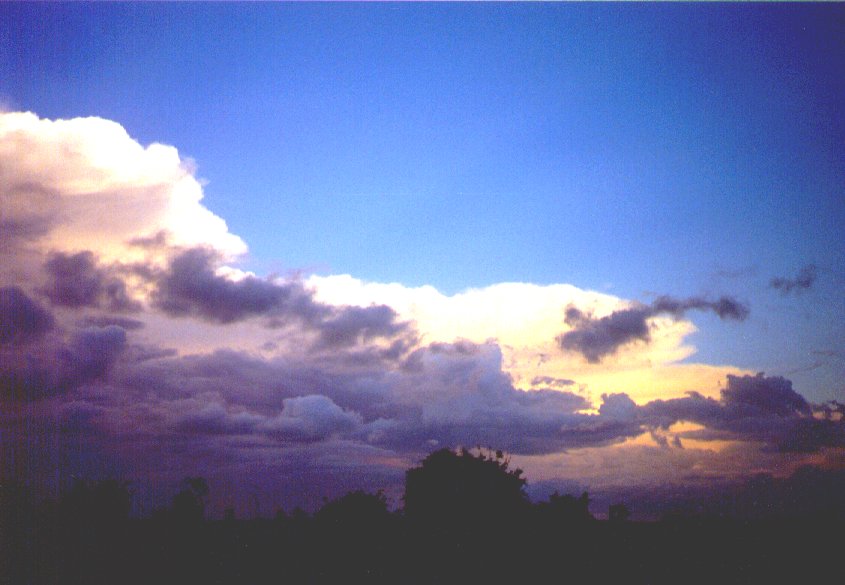
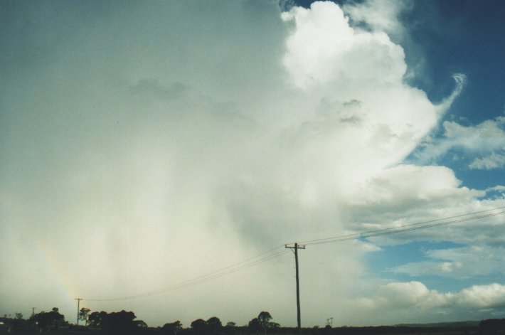
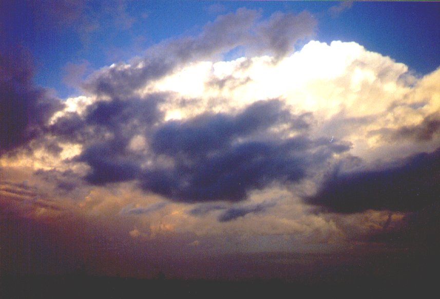 Images of the cell taken looking northeast from Woodburn 7.30pm 31st December 1999. What a fantastic New Year's gift it was!
31/12/99 10.47pm Aussie Weather email update by Anthony Cornelius
A nice lightning show to the SE, from a nice cell that formed over NE NSW today - it's now off the Gold Coast and out to sea. Very frequent lightning, about 3-4 flashes a second! The storm itself looks quite impressive!
Some (thundery?) showers are popping up on the border ranges to the SW/SSW - I'm watching these very closely, some Altocumulus Castellanus about, I'm currently sitting on 24.9C, DP is 20C and a light NE'er.
Will keep people updated should anything occur
31/12/99 11.11pm Aussie Weather email update by Ben Quinn
Probably the best lightning display of the year visible to the ESE tonight... absolutely jaw dropping stuff - lightning up to 3-4 times a second, and not like the storm last night where there were 2-3 second gaps in between the lightning every now and then - this lightning is constant, with very few breaks... there are periods of up to 4 seconds or so when there is not lightning in some part of the storm.
The best count I had (over 60 seconds) was 92 flashes... it was probably even more frequent at times, but somehow COUNTING the lightning flashes takes the fun out of it for me!
Lightning Tracker is only picking up about 63 CGs every 5 minutes at the moment, but 90% + of all the lightning is in cloud lightning.
It's quite warm here (Brisbane) at the moment, with a temp of 23c at the airport and a DP of 20c - AVN has been forecasting overnight showers or possibly storms for the past 24-36 hours, and there are currently some thundery showers on the border ranges (very sporadic lightning from them) - hopefully they will get going soon..
I have a feeling SE QLD is going to get clobbered overnight or tomorrow (more likely tomorrow).. it largely depends on how far north the SE change gets (which should be somewhere in NE NSW by now).
Just looking outside now, the storm has calmed down slightly with lightning mostly one per second now. What a great way to end the year!!!!!!
BRING IT ON!!!!!!!!!!!!!!!!!!!!!!!!!!!!!!!!!!!!!!!!!!!!!!!!!!!!!!!!!!!!!!!!!!!!!!!!!!!!!!!!!!!!!!!!!!!!!!!!!!!!!!!!
01/01/2000 12.25pm Aussie Weather email update by Paul Graham
Hi everyone, I was watching the Evans Head storm on the radar yesterday afternoon and I suspect it was probably a supercell given the intense radar echoes, long duration, NE movement relative to the NW steering winds and relative isolation compared to other cells to the SW. Although difficult to discern from the Weatherwatch rdar, it also appeared to have a bow echo at one stage. Does anyone know if there was any damage reported?
01/01/2000 12.59pm Aussie Weather email update by Michael Bath
Although I have not seen any radar of this, I can confirm that it was not a supercell - definitely severe multicell which developed about 3.30pm NW of Grafton and cleared the coast through Evans Head after 6pm. The system was slow moving and strong.
I had a perfect view of this storm from it's initial development (chase report following soon) and it only indicated multicell, with new updrafts developing on the NW flank every 30 minutes or so. Very little backshearing occurred. Precipitation was along a long line towards the E. Once the base came into view, I could see lowerings in two to three places along the line indicating the separate updrafts.
It did produce very strong winds (up to 50 knots) and small hail (was reported so far). Full description to follow.
I headed out on chase from Wollongbar at 1pm. AVN forecast of LI was only -2 to -3 and CAPE below 1000, winds up to 400hPa were W to WNW to only 30 knots, however at 200hPa it was a W at 90 knots. 500hPa temp was forecast to be around -12.
 There was a few congestus and scattered cumulus in a mostly sunny sky. A shower had developed SE of Casino in a congestus tower larger than any others visible - it was capped at about 5000m, and gave one crack of thunder that I heard at 1.50pm while I was just SW of Lismore. I hung around at this location for about 30 mins more with very little happening - just the odd congestus to the N on the hills, and to the SW and W popping up then collapsing. The temp was now about 30C. At this time (2.30pm) it was not looking good so I decided to drive out to Maccas at Casino to kill some time.
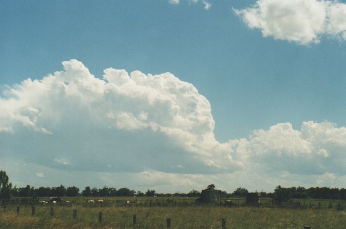
 At about 3.10pm I was looking to just go home when I heard on the radio that a severe storm advice had been issued for the Mid North Coast and Northern Rivers! What - nothing here! Literally two minutes later a congestus I had been watching for ages about 20ks to my south just punched higher than the rest. Fantastic - it's starting to happen - I was already heading E out of Casino so I continued till the Tatham exit on the Bruxner Highway. A crappy road which went to gravel for a while but at least great views in flat pasture land. I joined the Tatham Coraki Road by 3.30pm. The cell was peaking in height around the 8000m mark, about 5ks away, but seemed to be crapping out at this stage, which I didn't like of course. I headed S a bit down the Ellangowan Road but turned back after spotting the real action to the far south.....
 I raced SE towards Coraki as a very large storm system came into view, and a few ks further along the road a closer cell (previously obscured by other cloud) was gathering strength to my SW. I stopped for photos and to get a radar update. Anthony confirmed a line of weakening activity that was SE of Grafton. And a new system was devevloping to the NW of Grafton - my new target area. This storm quickly developed a very nice boiling updraft, easily reaching the 12,000 metre mark. Checking the map, one road connected where I was to Whiporie (on the Summerland Way between Grafton and Casino) - the likely first target of the storm. I drove down this road for about 10ks and heading SW straight at the storms NW flank, which was a fantastic sight. Unfortunately the road became gravel as the crop land turned into forest, so I backtracked a little and decided to wait it out for a while. It was now about 4.15pm and I was about 25ks from the storm base. It was obvious the storm would take a while to reach my location, with a slow propagation towards the ENE.

By 4.45pm I had moved back NE then SE along the Coraki Woodburn Road to near Swan Bay. The base was now becoming visible as the storm was clearing a few small forested hills to the SW and probably about 10ks from me. I then moved to Woodburn on a small farm road just SW of the town in flat pasture land for a fantastic view on the approaching system. Cumulus and/or stratocumulus patches was streaming in from the E/SE now, obscuring much of the storm structure, but it semmed to be streaming into the NW flank of the storm. Glimpses of the storm tops every few seconds showed the storm to be strong as ever. Fortunately, the base was not obscured at all, and was now putting on a very exciting show! From 5.10pm incredible lowerings, prongs, funnel shaped protrusions, and scuds were constant. Several times it appeared to be a wall cloud, and some clouds were almost to the ground. (the terrain here is probably only 10 to 20 metres above sea level).
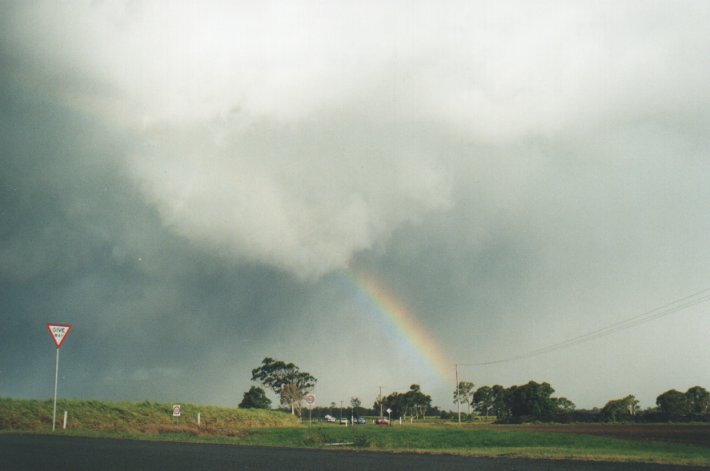
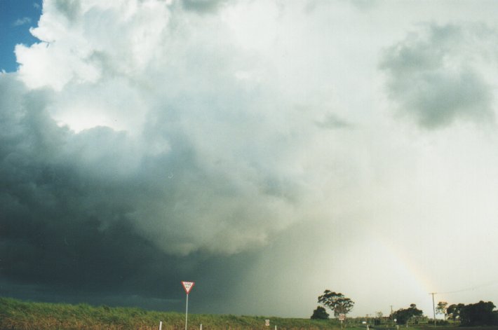
On the leading edge of a now pronounced gust front (~5.40pm) it did appear to be a gustnado - will have to check the video. The storm was now pretty close (less than 5ks) and lightning was showing nicely. To the W and NW and long tail of congestus was forming. Precipitation spread into the valley ahead (S and SW) and seemed to be wrapping around to the W - and likely to strike my location. Calls to and from Halden between Evans Head and Woodburn were nearly every minute! It was very exciting now and getting freaky with the precipitation that looked sure to hold hail advancing quickly now. I edged E into town then stopped on the SE fringe on the Evans Head road (6pm). Part of the storm was almost overhead and the gust front was now in Evans Head (giving Halden his hail). To my S was a wall of white plunging out the rear of the storm, followed a few seconds later by incredible gusting winds out of the S-SE. Some rain hit my location but fortunately for my car stayed to the SE. The winds continued, probably up to 50 knots, then the sun poked trough from behind lighting up a brilliant rainbow and a huge boiling updraft ahead to the E (~6.10pm). Scuds were flying in all directions just in front of me - awesome! The thought of a wall cloud and tornado crossed my mind several times and a report of the cell heading more northerly ... but ... it just did not have the right structure for it - a fanatstic sight with plenty of motion and winds, the hail shaft continuing just to the SE - but no organised rotation evident.
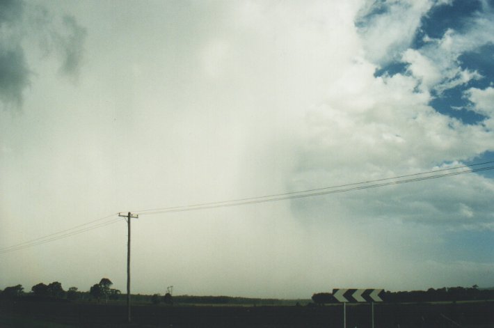
I panned the video around to get the entire scene and to my amazement a cell had shot straight up to the W, probably on the outflow from the Evans Head storm. It was very narrow, but right up there in height, and soon had heavy precipitation. (John Graham later reported to me hail at Coraki - which may have been from this cell). From the NW and into the Evans Head storm congestus was quickly forming, and beutifully illuminated by the low sun. After hearing from Halden that the hail was only small, I decided to head home: one, beacuse I had to go out soon; and two, the Coraki storm and other activity was forming S and SW of Lismore, and would likely cross where I live. It took just 35 minutes to drive home, arriving there just before 7pm. Some rain was falling from the congesting cumulus along the way.
A constant rumble of thunder filled the air, the sun was low and bright and was making it difficult to pick where the storm was. A rippled base came into view briefly to the W, just S of Lismore. Features were soon obscured by low cloud from the E, then large drops started to hit - it felt like hail was going to hit but only rain fell - for about 5 minutes. The storm passed through Lismore (10ks to my W, with hail reported) at 7.30pm and headed towards New Year's Eve celebrations at Byron Bay. Yippee! We (my wife and two young kids) left Wollongbar for my parents place at Ballina arriving by 8pm in time for the sky to be lit up with anvil crawlers, hopefully some of which will turn out on film. I believe this storm system moved off the coast through Byron and gave the Brisbane guys a view of the lightning when it was off the Tweed, 2 hours later.
At midnight just as all the fireworks went off it became apparent there was more happening in the sky than just crackers - another storm had strengthened SW of Ballina and was now giving off strobing lightning and fresh and cool S winds were ahead of it. (memories of the Drive In scene from Twister came to mind !) Jimmy rang me at 12.20am from a very noisy Sydney location watching the Sydney harbour fireworks, just as the storm began to hit Ballina. Strong gusty winds preceded small hail then torrential rain for several minutes - this gave 10mm. The rain continued till around 1am. This morning on the way home, trees had been stripped of leaves and twigs along the Bruxner Highway between the Pacific Highway turnoff and Alstonville - similar location to the night before (see my report of 30/12 storm). Obviously hail fell more profusely here.
Thanks to Halden, Anthony and Matt for updates.
Wouldn't be so sure myself Halden given that the upper flow (500 mb) was from the W/NW and up to 60 kts (500 mb) yesterday evening while the cell that passed through Evans Head was moving almost NE.
Cheers, Paul.
On Fri, 31 Dec 1999, Halden Boyd wrote:

> Not supercell mate...have some excellent pics of it which will be posted
> soon....cheers Halden
>
>
> >From: Paul Graham
> >Reply-To: [email protected]
> >To: [email protected]
> >Subject: Re: aus-wx: Evan's Head Storm...
> >Date: Fri, 31 Dec 1999 20:19:08 +0000 (GMT)
> >
> >Interesting, certainly looked like a supercell on radar...Did anyone save
> >the radar scans?
> >- Paul G.
02/01/2000 3.51am Aussie Weather email update by Leslie R. Lemon
Michael Bath wrote:

> I had a perfect view of this storm from it's initial development (chase
> report following soon) and it only indicated multicell, with new updrafts
> developing on the NW flank every 30 minutes or so. Very little
backshearing
I am not saying that this particular storm was a supercell, but I do want to mention a word of caution when considering the visual (or often even the radar appearance) of storms. As we all know, supercells are often accompanied by a trailing flanking line of convective towers along the outflow boundary. These same cells or congestus towers will normally overtake and merge with the storms updraft region and often lose their individual identity. However, not uncommonly, these cells will not lose their identity but will travel through the storm complex, often along the rear echo flank. But at other times, these or other flanking cells will grow explosively and merge with the storm , playing a vital role in production of additional mesocyclone cores and severe weather. Thus, both on radar and visually the storm will exhibit both multicell and supercell traits simultaneously.
Many have written on this process, including myself. For the first time and in my first publication, I wrote on this process in 1970. I have written on it again since.
Many of our concepts of steadiness and the 'single' cell nature of the supercell were developed when radar resolution was relatively poor and the visual storm appearance had little to do with storm research. Moreover, many neglected the statements that the supercell was relatively steady and single cellular for the periods of time required for a parcel of air to pass into and through the storm. That did (and does) not mean that it remained that way for much longer time spans. Note that researchers at the National Center for Atmospheric Research (NCAR) in Boulder, CO during the early 1980's even suggested a 'new' storm type called the "West Plains" storm, which was more weakly multicellular and evolutionary than the multicell storm but more unsteady and multicellular than our concept of the supercell at that time. Now the primary storm classification system includes only the "ordinary" and the "supercell" storm. Both may be multicellular (and probably are). However, the secondary classification scheme with includes the single cell, the multicellular cluster storm, the supercell, and the multicellular line storm is still used as well. Many, including myself, doubt the existence of truly single cell storms. As our instrumentation resolution improves and our visual understanding improves as well, the multicellular nature of all convection is becoming more widely accepted.
02/01/2000 2.59pm Aussie Weather email update by Daniel Weatherhead
I think that this is a good example and a good lesson on the difference between what is on radar, and what a spotter actually sees. Sometimes storm systems can look great on radar, and hint a possible supercell characteristics, but plainly not be a supercell to the spotter observing. Of course it works on the flip side. Some storms can look like nothing sometimes yet hold features that the radar hasn't or can't pick up.
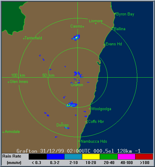
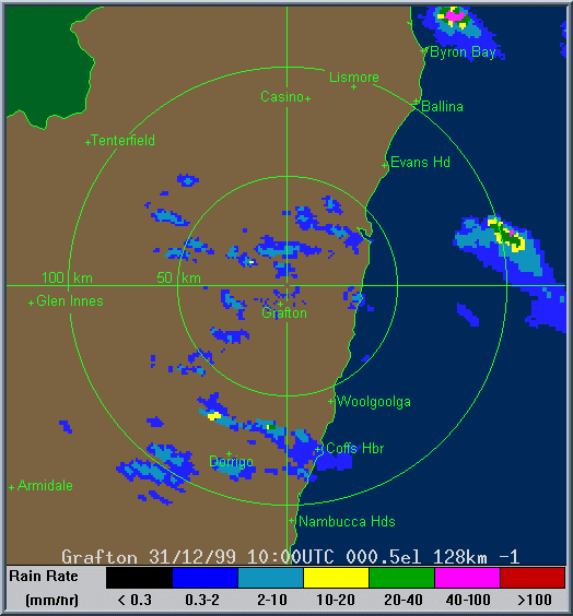
Radar
These images from Bureau of Meteorology
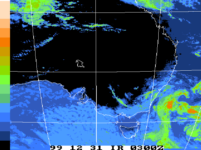
Satellite Images
These images from Bureau of Meteorology
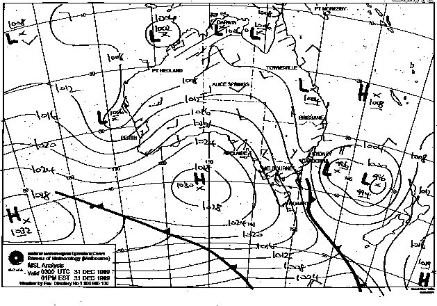
MSL Analysis Charts
This image obtained from Bureau of Meteorology.
2pm local 31st December 1999
|
Document: 9912-04.html
Updated: 13th January, 2003 |
[Australian Severe Weather index] [Copyright Notice] [Email Contacts] [Search This Site] |